Stream Bank Erosion Site BC-08
Total Severity: Severe
Total Points: 37
Information collected by:
Bear Creek Watershed,
Bear Creek
Maple Grove Twp,
Manistee County
GPS Coordinates: 44.35065
, -86.05121
T23N
R14W
Sec 31
Owned by Private
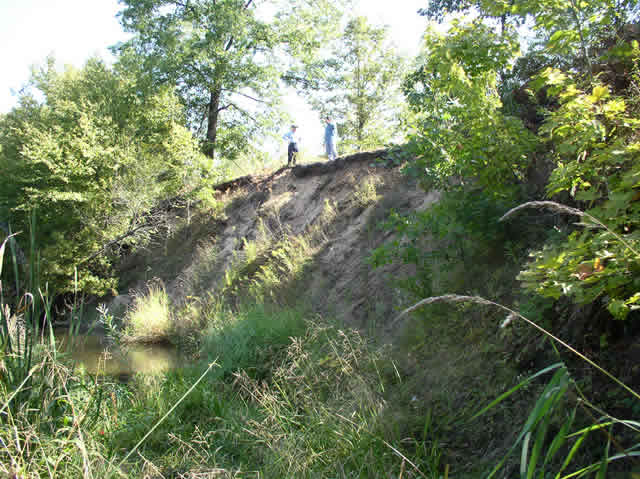
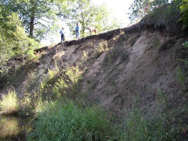
Bank Details
Which Bank? Left
Bank Aspect:W
Condition:Both toe and upper bank eroding
Erosion Trend:Increasing
Percent Veg. Cover: 10-50%
Bank Conditions
Stream Width:50 ft.
Stream Depth:3 ft.
Stream Current:Slow
Eroded Bank Length:100 ft.
Eroded Bank Height:30 ft.
Slope of Eroded Bank:2:1
Texture: Sand
Cause(s) of Erosion
-Bend in river
-Bank seepage
-Foot traffic
Recommended Treatment(s)
-Bank revegetation
-Rock riprap
-Cover structure
General Information
Total Points
37
�