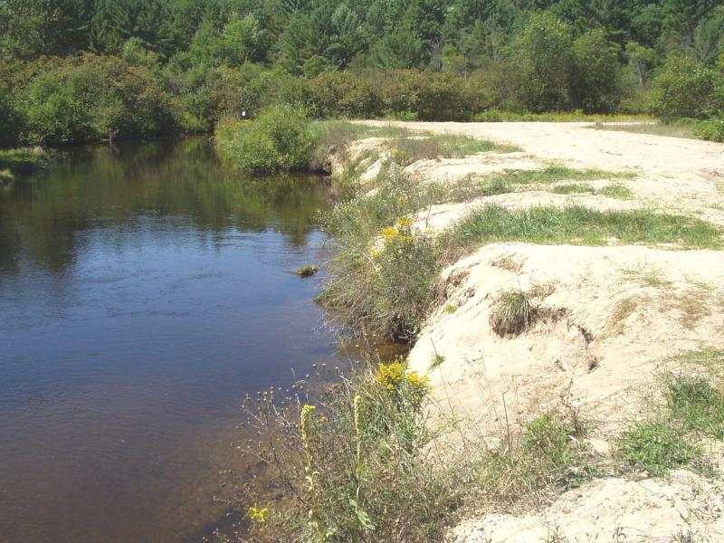
Stream Bank Erosion Site BRD-S793
Total Severity: Severe
Total Points: 32
Information collected by:
Boardman River Watershed,
North Branch Boardman River
Whitewater Twp,
Grand Traverse County
GPS Coordinates: 44.7010436
, -85.34473728
T27N
R9W
Sec 25
Owned by State
Site Access:Yes
Bank Details
Which Bank? Right
Condition:Both toe and upper bank eroding
Erosion Trend:Increasing
Percent Veg. Cover: 10-50%
Bank Conditions
Stream Width:30 ft.
Stream Current:Slow
Eroded Bank Length:100 ft.
Eroded Bank Height:5 ft.
Slope of Eroded Bank:Vertical
Texture: Sand
Cause(s) of Erosion
-Foot traffic
Other causes: Failing access pad
Recommended Treatment(s)
Other Treatments:Work with MDNR for an acceptable treatment
General Information
Guernsey Lake Road sand trap
200 ft long sand trap, half of entire right bank is seriously eroding.
Access pad need stabilization.
200 ft long sand trap, half of entire right bank is seriously eroding.
Access pad need stabilization.
Total Points
32

