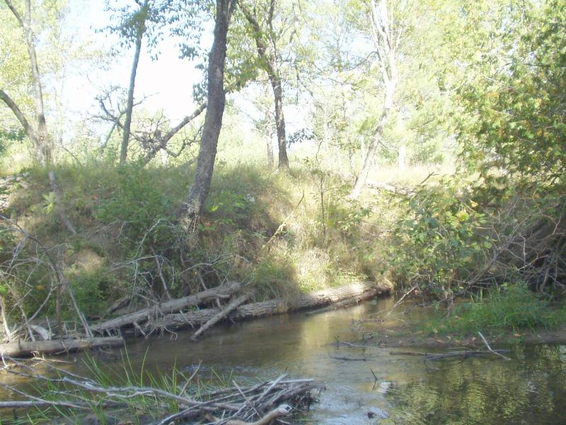
Stream Bank Erosion Site BRD-S473
Total Severity: Restored
Total Points: 18
Information collected by:
Boardman River Watershed,
North Branch Boardman River
Whitewater Twp,
Grand Traverse County
GPS Coordinates: 44.69266533
, -85.35686275
T27N
R9W
Sec 35
Owned by Private
Site Access:Yes
Bank Details
Which Bank? Right
Erosion Trend:Stable
Percent Veg. Cover: 50-100%
Bank Conditions
Stream Width:30 ft.
Stream Depth:12 in.
Stream Current:Moderate
Eroded Bank Length:35 ft.
Eroded Bank Height:8 ft.
Slope of Eroded Bank:2:1
Texture: Sand
Cause(s) of Erosion
-Obstructions in river
-Foot traffic
Recommended Treatment(s)
General Information
Leave log jam in place... site has been stabilized through CMI work.
BMPs Completed:
woody debris
bank shaping
topsoil
bank shaping
topsoil
Total Points
18
�