Stream Bank Erosion Site BRD-S865
Total Severity: Severe
Total Points: 33
Information collected by:
Boardman River Watershed,
North Branch Boardman River
Union Twp,
Grand Traverse County
GPS Coordinates: 44.68043275
, -85.38824409
T26N
R9W
Sec 3
Owned by Private
Site Access:???
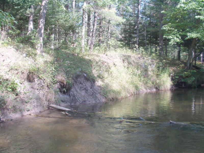
Bank Details
Which Bank? Right
Condition:Both toe and upper bank eroding
Erosion Trend:Increasing
Percent Veg. Cover: 10-50%
Bank Conditions
Stream Width:26 ft.
Stream Depth:20 in.
Stream Current:Moderate
Eroded Bank Length:80 ft.
Eroded Bank Height:8 ft.
Slope of Eroded Bank:Vertical
Texture: Clay
Cause(s) of Erosion
-Bend in river
-Foot traffic
Recommended Treatment(s)
-Tree revetments
Other Treatments:Monitor this site
General Information
Relatively minor slumping.
Clay bank is not advancing fast.
Clay bank is not advancing fast.
Total Points
33
�