Stream Bank Erosion Site BRD-S885
Total Severity: Minor
Total Points: 27
Information collected by:
Boardman River Watershed,
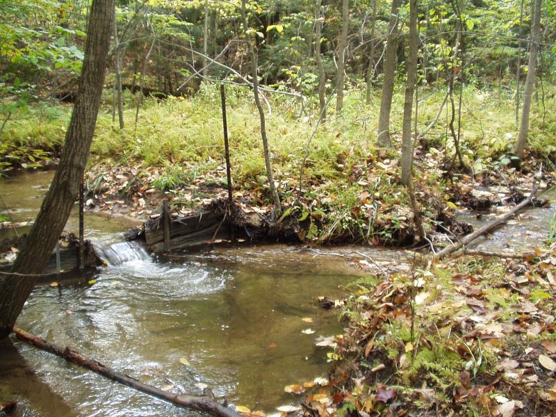
Robbin's Creek
Garfield Twp,
Grand Traverse County
GPS Coordinates: 44.69946372
, -85.63331314
T27N
R11W
Sec 34
Owned by Private
Site Access:Yes
Bank Details
Which Bank? Both
Condition:Both toe and upper bank eroding
Erosion Trend:Increasing
Percent Veg. Cover: 10-50%
Bank Conditions
Stream Width:4 ft.
Stream Depth:4 in.
Stream Current:Moderate
Eroded Bank Length:10 ft.
Eroded Bank Height:1 ft.
Slope of Eroded Bank:Vertical
Cause(s) of Erosion
-Obstructions in river
Recommended Treatment(s)
-Obstruction removal
General Information
Soil texture: sand / loam
Old railroad tie dam is blocking fish migration and causing upstream flooding.
Old railroad tie dam is blocking fish migration and causing upstream flooding.
Total Points
27
�