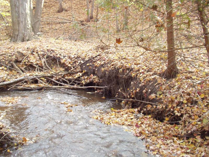
Stream Bank Erosion Site BRD-S334
Total Severity: Severe
Total Points: 34
Information collected by:
Boardman River Watershed,
Jack's Creek
Garfield Twp,
Grand Traverse County
GPS Coordinates: 44.71104096
, -85.62750227
T27N
R11W
Sec 27
Owned by Private
Site Access:Yes - off Cass Road
Bank Details
Which Bank? Right
Condition:Both toe and upper bank eroding
Erosion Trend:Increasing
Percent Veg. Cover: 0-10%
Bank Conditions
Stream Width:8 ft.
Stream Depth:3 in.
Stream Current:Fast
Eroded Bank Length:25 ft.
Eroded Bank Height:3 ft.
Slope of Eroded Bank:Vertical
Texture: Sand
Cause(s) of Erosion
-Bend in river
Recommended Treatment(s)
-Tree revetments
General Information
Woody debris has started to build up at downstream end of site. More should be added to the upstream end.
Total Points
34
�