Stream Bank Erosion Site BGMN-074
Total Severity: Moderate
Total Points: 33
Information collected by:
Big Manistee River Watershed,
Wexford Twp,
Wexford County
GPS Coordinates: 44.43706
, -85.70139
T24N
R12W
Sec 36
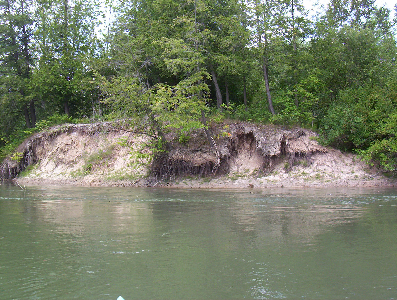
Bank Details
Which Bank? Right
Bank Aspect:SE
Condition:Both toe and upper bank eroding
Erosion Trend:Increasing
Percent Veg. Cover: 0-10%
Bank Conditions
Stream Width:100 ft.
Stream Depth:4 ft.
Stream Current:Slow
Eroded Bank Length:50 ft.
Eroded Bank Height:20 ft.
Slope of Eroded Bank:3:1
Texture: Sand
Cause(s) of Erosion
-Bank seepage
-Foot traffic
Recommended Treatment(s)
-Bank revegetation
-Rock riprap
-Tree revetments
General Information
Total Points
33
�