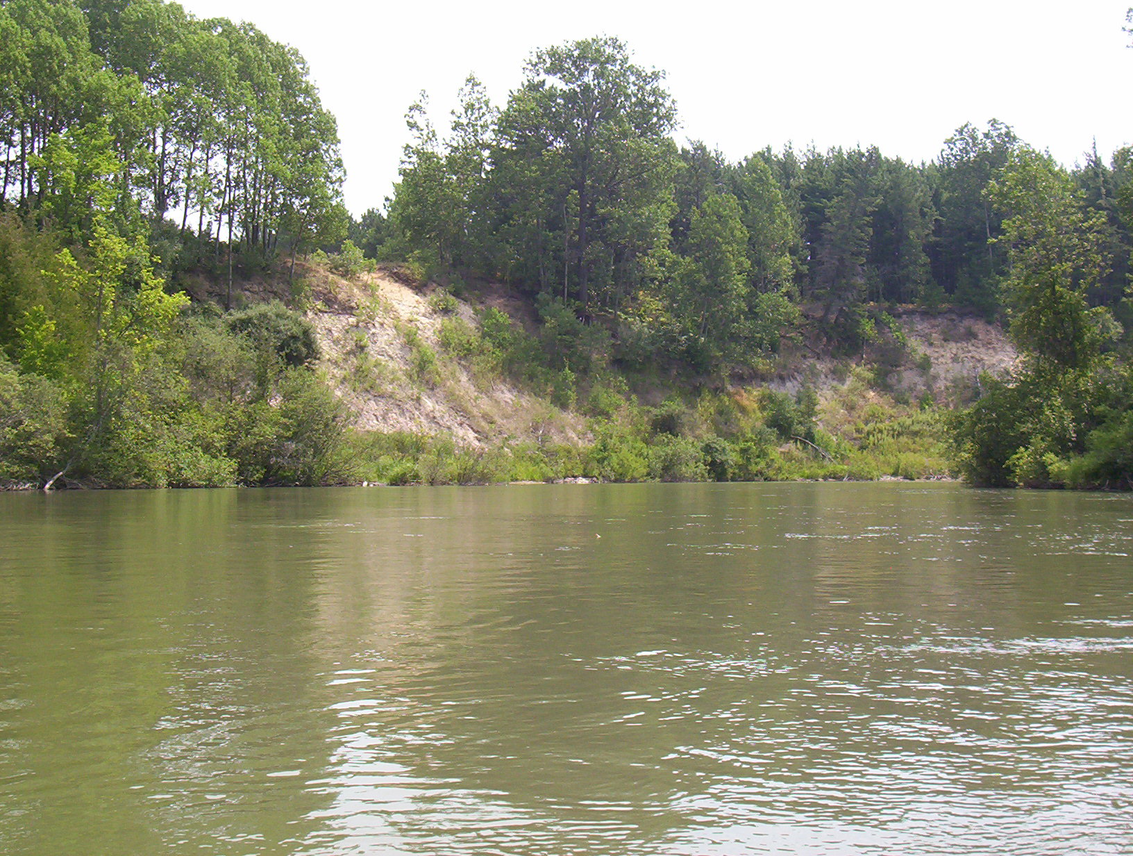
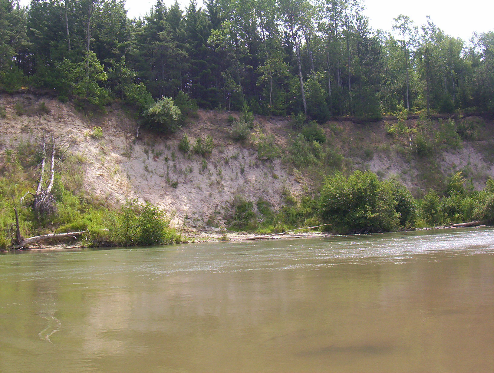
Stream Bank Erosion Site BGMN-075
Total Severity: Minor
Total Points: 24
Information collected by:
Big Manistee River Watershed,
Wexford Twp,
Wexford County
GPS Coordinates: 44.43021
, -85.70555
T24N
R12W
Sec 36
Bank Details
Which Bank? Left
Bank Aspect:S
Condition:Toe is stable; upper bank eroding
Erosion Trend:Stable
Percent Veg. Cover: 50-100%
Bank Conditions
Stream Width:80 ft.
Stream Depth:4 ft.
Stream Current:Slow
Eroded Bank Length:350 ft.
Eroded Bank Height:60 ft.
Slope of Eroded Bank:3:1
Texture: Sand
Cause(s) of Erosion
-Bend in river
-Bank seepage
Recommended Treatment(s)
-Bank revegetation
-Tree revetments
General Information
Total Points
24
�