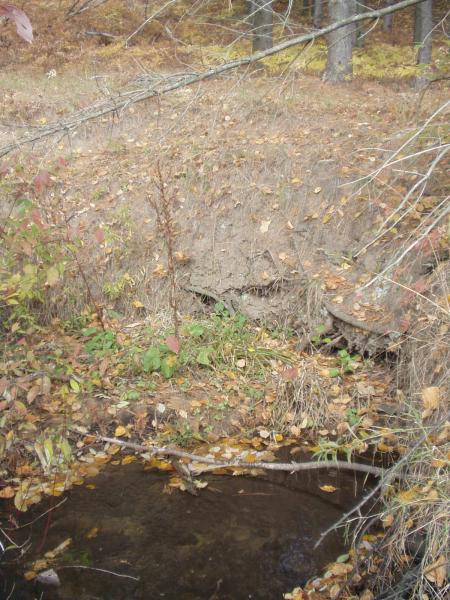
Stream Bank Erosion Site BRD-S350
Total Severity: Minor
Total Points: 27
Information collected by:
Boardman River Watershed,
Miller Creek
Garfield Twp,
Grand Traverse County
GPS Coordinates: 44.72156918
, -85.63459739
T27N
R11W
Sec 22
Owned by Private
Site Access:Yes - Miller Creek Trail
Bank Details
Which Bank? Left
Condition:Both toe and upper bank eroding
Erosion Trend:Stable
Percent Veg. Cover: 10-50%
Bank Conditions
Stream Width:6 ft.
Stream Depth:4 in.
Stream Current:Fast
Eroded Bank Length:20 ft.
Eroded Bank Height:6 ft.
Slope of Eroded Bank:Vertical
Texture: Sand
Cause(s) of Erosion
-Bend in river
Recommended Treatment(s)
-Obstruction removal
-Bank revegetation
Other Treatments:Coir fiber rolls
General Information
Old decaying metal tub in creek, actually diverting flow away from eroding bank. Just upstream of where the Miller Creek Trail crosses the creek.
Total Points
27

