Small Dam Site AUSD_107
Au Sable River Watershed, Tributary to Beaver Creek
Tributary to Beaver, South Branch Au Sable River
Crawford County
Information collected by:
GPS Coordinates: 44.52652297
, -84.6914378
T25N
R03W
Sec 29
Access Road: Grayling Rd
Local Government Ownership
0.05 Upstream Miles Reconnected
Ranking: 5
Site Location
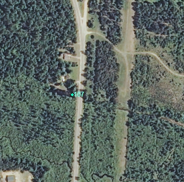
Aerial
Land Use Information
Upstream-Forest
Upstream-Wetland
Upstream-Residential
Downstream-Forest
Downstream-Wetland
Impoundment or Dam Use Information
Recreation
Wildlife Pond
Waterfront Development
Structural Information
Barrier Type
Undersized Culvert
Other Barrier Types:
Elevation difference (dug pond?)
Construction Materials
Concrete
Other Site Features
Vehicle Access
Attached or Adjacent Buildings
Upstream Conditions
Widening
Deepening
Loss of Channel / Partially Lake
Is there evidence of erosion?
Upstream
At Structure
Downstream
Can bankfull width upstream of Impoundment be determined? no
Direct Stream Measurements
Stream
Widest Impoundment Width (ft): 30
Impoundment Length (ft): 288
Spillway
Structure Characteristics
Other Pertinent Information
Physical Condition Ranking: 5
Dominant substrates UPSTREAM: muck
Dominant substrates DOWNSTREAM: wetland
Dam has ability to regulate water level? no
Is the dam being actively managed? no
Is another dam or road crossing visible up or down stream? no
Are there any invasive species easily identified? no
This page last updated on 7/6/2022.
�