Small Dam Site AUSD_124
Au Sable River Watershed, Middle Branch Big Creek
Tributary to North Branch Au Sable River
Crawford County
Information collected by:
GPS Coordinates: 44.75407924
, -84.37685589
T27N
R01W
Sec 12
Access Road: Walsh
Private Ownership
0 Upstream Miles Reconnected
Ranking: undefined
Site Location
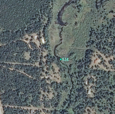
Aerial
Land Use Information
Upstream-Forest
Upstream-Wetland
Downstream-Forest
Downstream-Wetland
Impoundment or Dam Use Information
Impoundment/Dam Other:
Beaver - pipes have been put in dam to help make river flow; appears to be ongoing beaver problem as it looks as if dam has been removed many times. Beaver sticks piled up 10 feet high.
Structural Information
Barrier Type
Beaver Dam
Construction Materials
Earth
Wood
Other Site Features
Upstream Conditions
Widening
Deepening
Loss of Channel / Partially Lake
Change to Lake / Pond
Is there evidence of erosion?
Upstream
At Structure
Downstream
Can bankfull width upstream of Impoundment be determined? no
Direct Stream Measurements
Stream
Impoundment Length (ft): 100
Area of Impoundment (sf): 2 acres
Spillway
Structure Characteristics
Height of Head (ft): 2
Other Pertinent Information
Physical Condition Ranking: undefined
Dam has ability to regulate water level? no
Is the dam being actively managed? no
Is another dam or road crossing visible up or down stream? no
Are there any invasive species easily identified? no
This page last updated on 7/6/2022.
�