Road Stream Crossing Site PIGN_DC01
Pigeon River Watershed, Duck Creek
Beckett Rd
Otsego County
Information collected by:
Site Location
GPS Coordinates: 45.0152366,-84.5164133
T 030N R 002 Sec 02
Fish Passability: Barrier
Perch Height: 1 ft.
Total Erosion: 3.64 tons/year
Overall Score: 28
Severity: Severe
Date Inventoried: 9/9/2021

Road Approach - Left
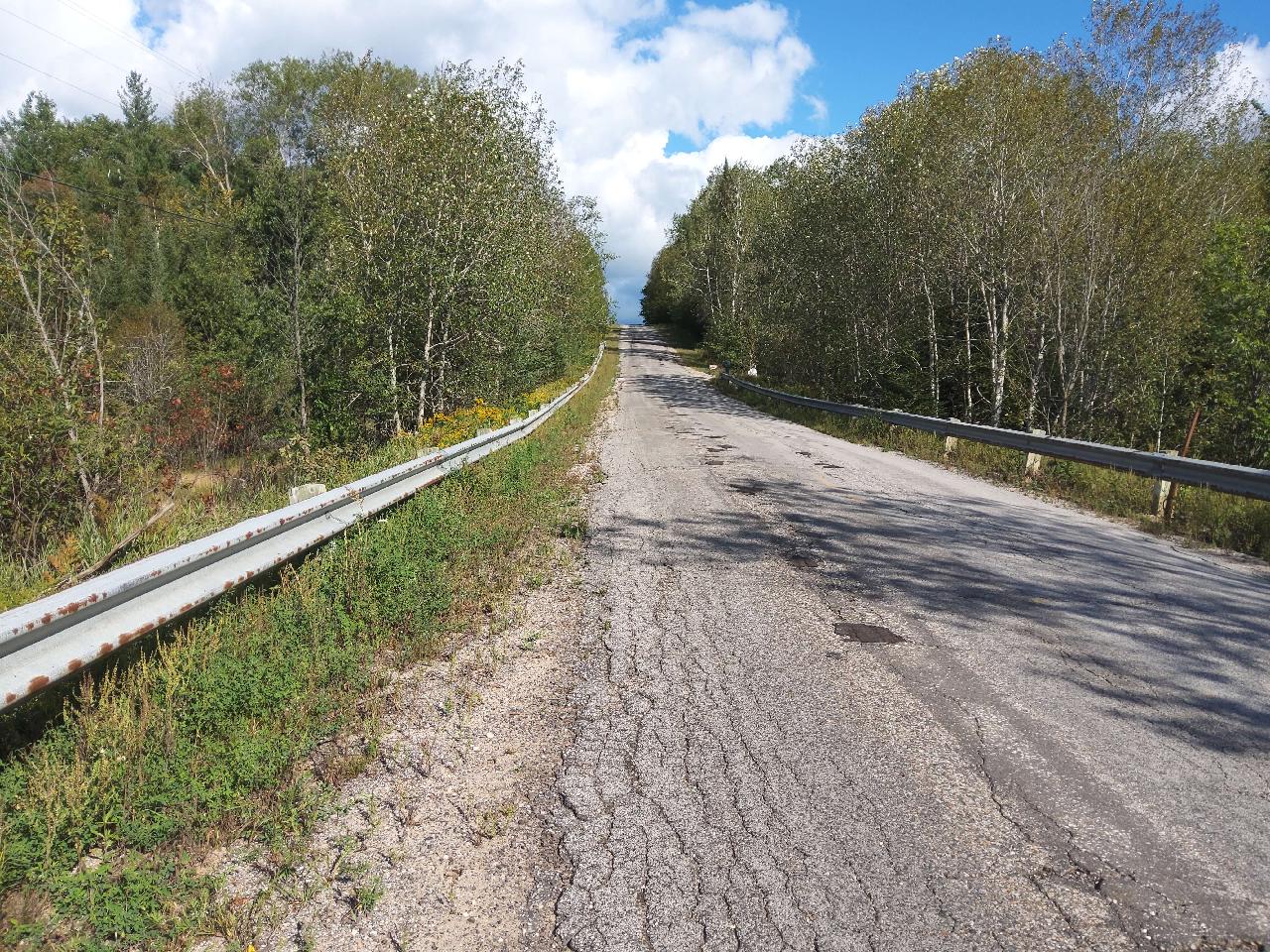
Road Approach - Right

Inlet

Upstream Conditions

Outlet

Downstream Conditions

Site Sketch
Crossing Information*
Type of Crossing: Culvert(s)
Number of Structures: 1
Structure Shape: Round
Inlet Type: Projecting
Outlet Type: Freefall into Pool
Structure Material: Metal
Structure Substrate: None
General Conditions: Major deterioration from corrosion or abrasion (5-10% of the structure is rusted through) or cracking or spalling or chipping (medium sized cracks, widespread chipping, exposed metal reinforcement). OR Major shape changes (described above) reducing the capacity of the structure by less than 30%. OR segment disconnection (segments of concrete or metal culvert disconnecting internally) but no evidence of water piping.
Structure Interior: Corrugated
Is Structure Rusted through? Yes
Dimensions of Structure: Length 48.5 ft. Width 3 ft. Height 3 ft.
Percentage Plugged: None or 0%
Percentage Crushed: None or 0%
Perch Height: 1 ft.
Structure Inlet
Water Depth: 1 ft.
Embedded Depth of Structure: 0 ft.
Water Velocity*: 1.9 ft./sec.
Structure Outlet
Water Depth: 1 ft.
Embedded Depth of Structure: 0 ft.
Water Velocity*: 1.4 ft./sec.
*Water Velocities were measured 0.8 ft. below the surface (via Flow Meter).
Stream Information
Stream Flow: < Bankfull � The stream channel is more than half filled with water, but is not full.
Stream Flow Type: Perennial (if flowing during the time of assessment.)
Is Scour Pool Present? No
Is Upstream Ponding Present? No
Riffle Information
Road Information
Road Surface: Paved
Owner: County
Road Condition: Broken Pavement or Rilled/Gullied, Multiple patches, cracks, rilling, or gullies at crossing.
Road Core Integrity: Poor (one or more symptoms are present and are compromising the integrity of the crossing)
Road Width at Culvert: 19 ft.
Location of Low Point: Other
Runoff Path: Roadway
Embankments
Upstream
Fill Depth: 8 ft.
Slope: Steep, 1:1, 45�, or 100%
Downstream
Fill Depth: 8 ft.
Slope: Steep, 1:1, 45�, or 100%
Approaches
Left Approach
Length: 0 ft.
Slope: < 1%
Vegetation: Heavy, Ditch is fully vegetated or rip-rapped with no signs of erosion.
Erosion Estimate: 0 tons/year
Right Approach
Length: 1000 ft.
Slope: < 1%
Vegetation: Heavy, Ditch is fully vegetated or rip-rapped with no signs of erosion.
Erosion Estimate: 3.64 tons/year
Erosion Information
Estimate of Total Erosion at Crossing: 3.64 tons/year
Summary Information
Fish Passability: Barrier
Is a future visit to this site recommended? No
Were any non-native species observerd at this site? Yes, Leafy spurge, reed canarygrass, wild parsnip.
Site Comments: Bankful width not recorded. Very protective private landowners on both sides. Use caution with future site visits, we were confronted.
*These data are maintained in the Michigan DNR Road Stream Crossing Inventory.
�