Road Stream Crossing Site UBR_CC01
Upper Black River Watershed, Packer Creek
Rouse Rd
Montmorency County
Information collected by:
Site Location
GPS Coordinates: 45.0750498,-84.2154653
T 031N R 002 Sec 17
Fish Passability: Barrier at High Flows
Structure is NOT Perched
Total Erosion: 4.3 tons/year
Overall Score: 15
Severity: Moderate
Date Inventoried: 10/7/2021

Road Approach - Left

Road Approach - Right
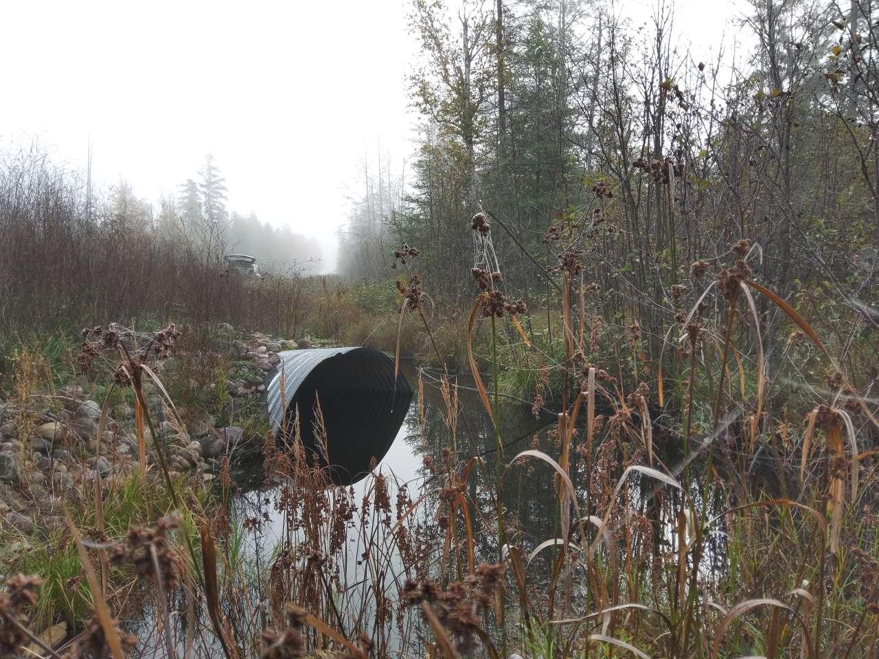
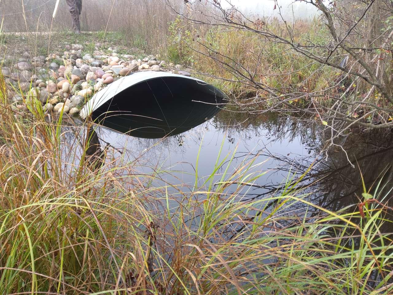
Inlet
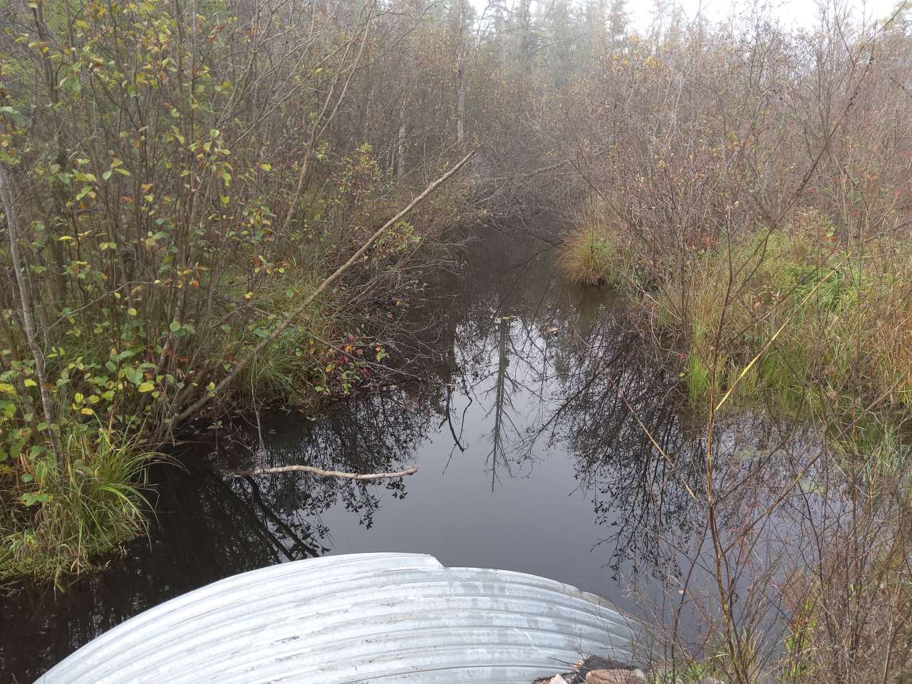
Upstream Conditions
Outlet
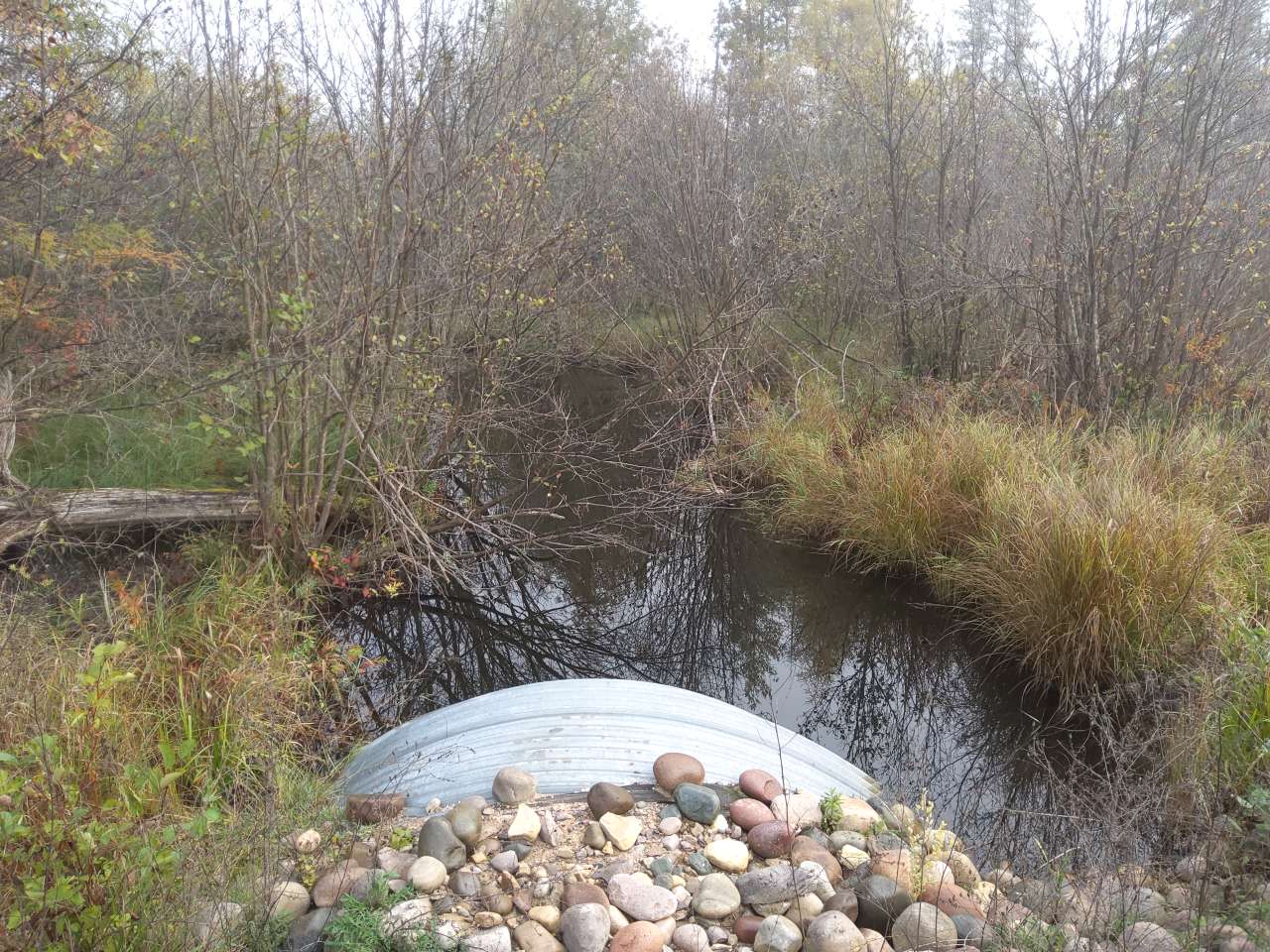
Downstream Conditions

Other
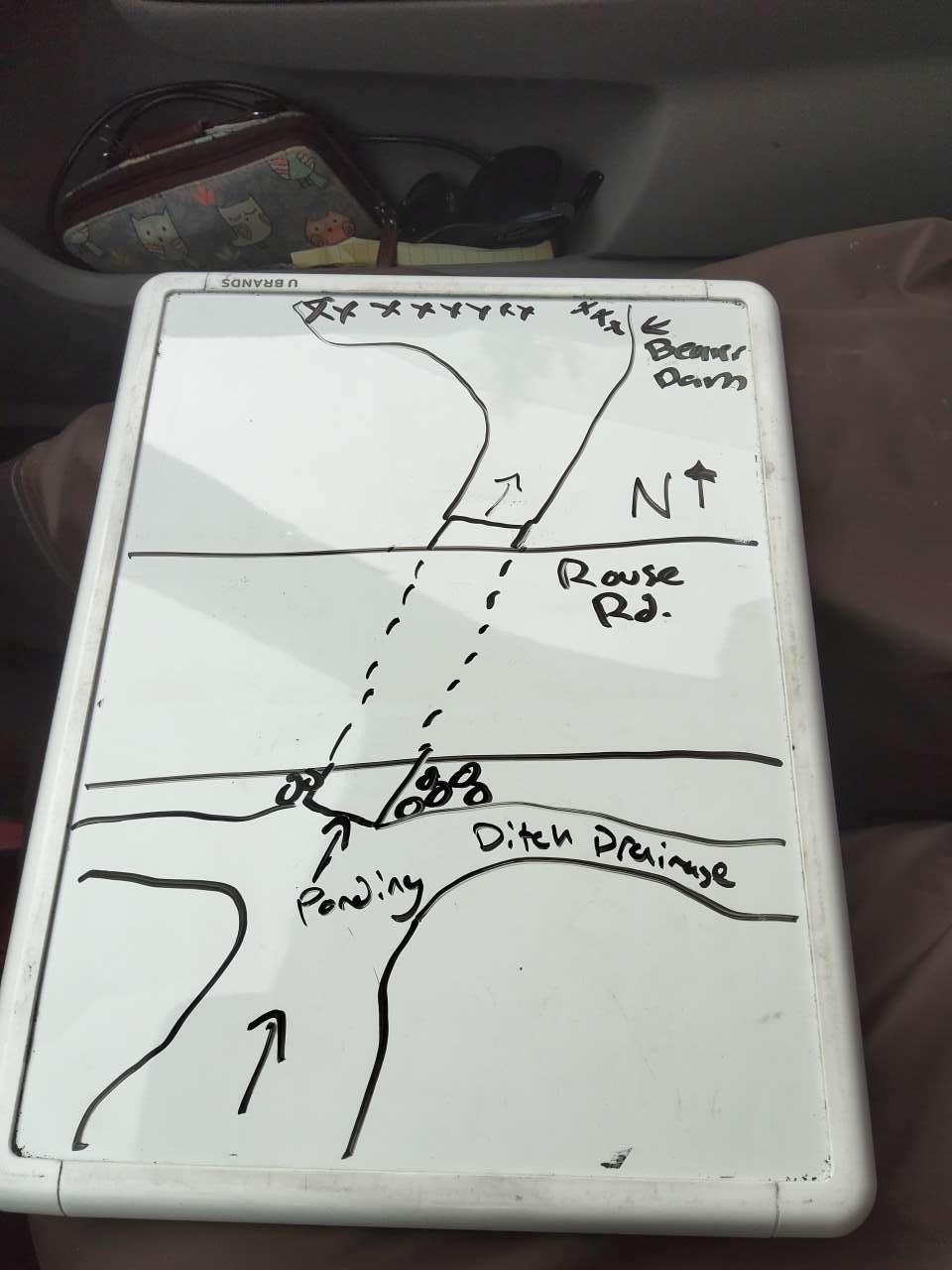
Site Sketch
Crossing Information*
Type of Crossing: Culvert(s)
Number of Structures: 1
Structure Shape: Pipe Arch
Inlet Type: Projecting
Outlet Type: At Stream Grade
Structure Material: Metal
Structure Substrate: Sand
General Conditions: No deficiencies. New structure or nearly new condition.
Structure Interior: Corrugated
Is Structure Rusted through? No
Dimensions of Structure: Length 49 ft. Width 7.5 ft. Height 10 ft.
Percentage Plugged: None or 0%
Percentage Crushed: None or 0%
Structure is NOT Perched
Structure Inlet
Water Depth: 5 ft.
Embedded Depth of Structure: 0.4 ft.
Water Velocity*: 0.1 ft./sec.
Structure Outlet
Water Depth: 4 ft.
Embedded Depth of Structure: 2 ft.
Water Velocity*: 0.1 ft./sec.
*Water Velocities were measured 3.8 ft. below the surface (via Flow Meter).
Stream Information
Stream Flow: > Bankfull � Water has filled the stream channel and is flowing onto the floodplain.
Stream Flow Type: Perennial (if flowing during the time of assessment.)
Is Scour Pool Present? No
Is Upstream Ponding Present? Yes
Pond: Length 11 ft., Width 7 ft.
Riffle Information
Water Depth: 1.2 ft.
Bankfull Width: 16.5 ft.
Wetted Width: 14.5 ft.
Water Velocity: 0.3 ft./sec. (measured via Flow Meter)
Dominant Substrate: Organics � decomposing plant material
Road Information
Road Surface: Gravel
Owner: County
Road Condition: New Pavement or Well Graded, Same condition as initial placement.
Road Core Integrity: Good (no symptoms of lack of integrity)
Road Width at Culvert: 19.5 ft.
Location of Low Point: Other
Runoff Path: Ditch
Embankments
Upstream
Fill Depth: 0.6 ft.
Slope: Gentle, 3:1, 15�, or 33%
Downstream
Fill Depth: 2 ft.
Slope: Gentle, 3:1, 15�, or 33%
Approaches
Left Approach
Length: 0 ft.
Slope: < 1%
Vegetation: Partial, Ditch has some vegetation and some bare, eroding places.
Erosion Estimate: 0 tons/year
Right Approach
Length: 1000 ft.
Slope: < 1%
Vegetation: Partial, Ditch has some vegetation and some bare, eroding places.
Erosion Estimate: 4.3 tons/year
Erosion Information
Estimate of Total Erosion at Crossing: 4.3 tons/year
Summary Information
Fish Passability: Barrier at High Flows
Is a future visit to this site recommended? Yes, Beaver dam needs removal.
Were any non-native species observerd at this site? Yes, Spotted knapweed, white sweet clover.
Site Comments: Downstream beaver dam
Representaive reach measurements from previous inventory.
*These data are maintained in the Michigan DNR Road Stream Crossing Inventory.
�