Road Stream Crossing Site EUP_6337691087
Pine River Watershed, Unnamed
S chub creek
Chippewa County
Information collected by:
Superior Watershed Partnership
Site Location
GPS Coordinates: 46.1650777520001,-84.628823391
T 044NN R 003W Sec 36
Fish Passability: Barrier at High Flows
Structure is NOT Perched
Total Erosion: 0.46 tons/year
Overall Score: 20
Severity: Moderate
Date Inventoried: 5/27/2021

Road Approach - Left
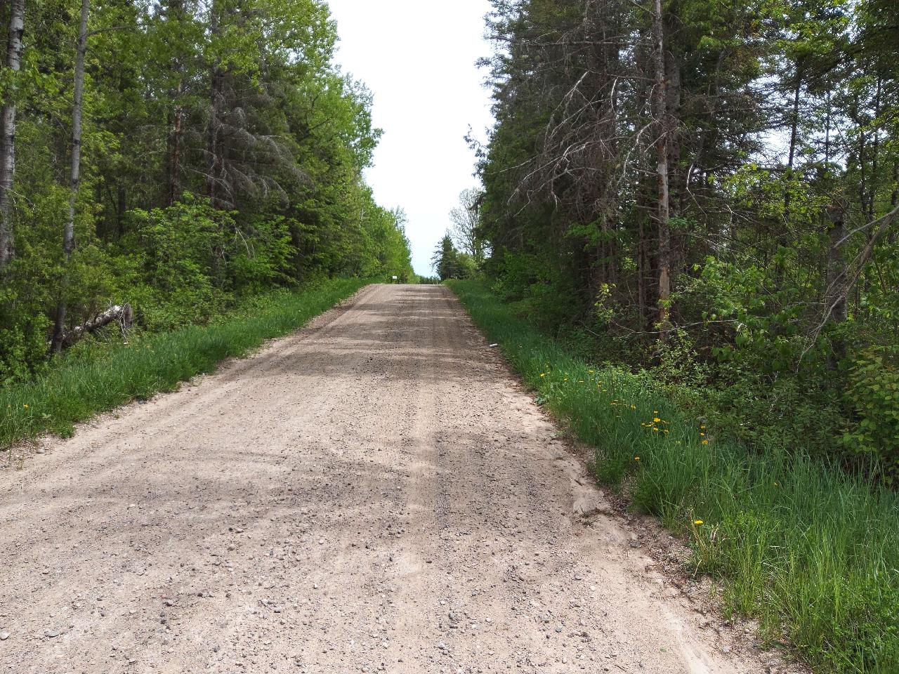
Road Approach - Right

Inlet

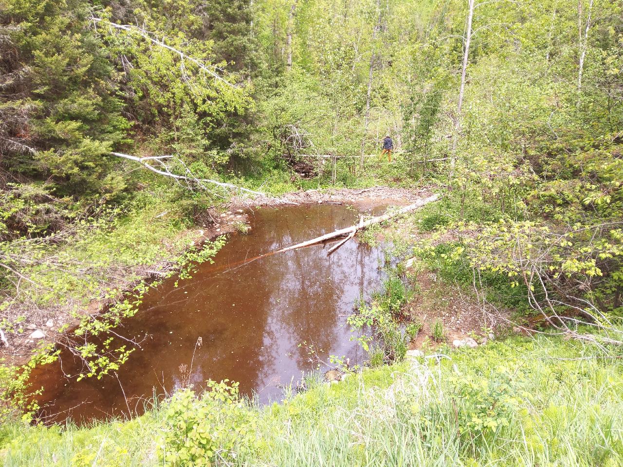
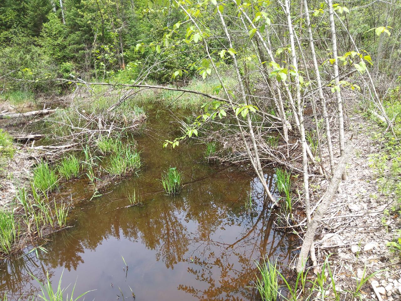
Upstream Conditions

Outlet
Downstream Conditions
Representative Reach
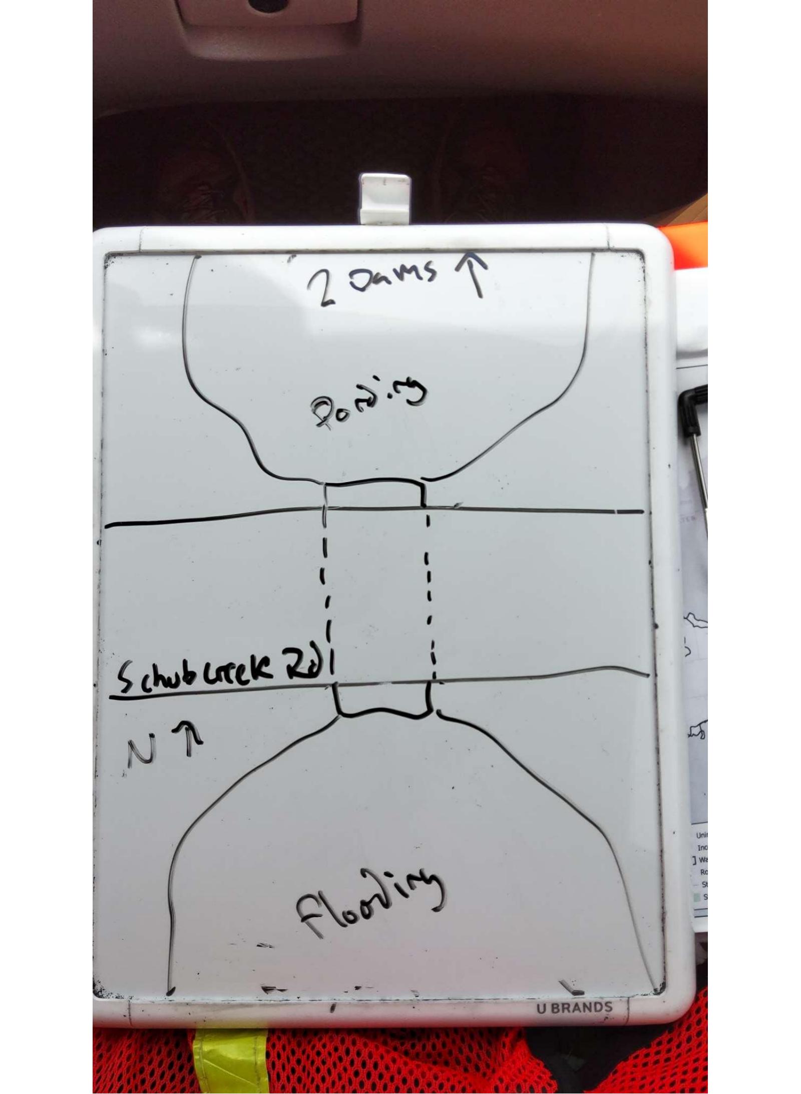
Site Sketch
Crossing Information*
Type of Crossing: Culvert(s)
Number of Structures: 1
Structure Shape: Round
Inlet Type: Projecting
Outlet Type: At Stream Grade
Structure Material: Plastic
Structure Substrate: None
General Conditions: No deficiencies. New structure or nearly new condition.
Structure Interior: Smooth
Is Structure Rusted through? No
Dimensions of Structure: Length 62 ft. Width 3 ft. Height 3 ft.
Percentage Plugged: None or 0%
Percentage Crushed: None or 0%
Structure is NOT Perched
Structure Inlet
Water Depth: 3 ft.
Embedded Depth of Structure: 0 ft.
Water Velocity*: 0 ft./sec.
Structure Outlet
Water Depth: 3 ft.
Embedded Depth of Structure: 0 ft.
Water Velocity*: 0 ft./sec.
*Water Velocities were measured at the surface (via Flow Meter).
Additional Comments
Updated by Huron Pines. L. Schmock, N. Theisen
Stream Information
Stream Flow: < 1/2 Bankfull � The stream channel is less than half filled with water.
Stream Flow Type: Perennial (if flowing during the time of assessment.)
Is Scour Pool Present? Yes
Scour Pool: Length 44 ft., Width 47 ft., Depth 5 ft.
Is Upstream Ponding Present? Yes
Pond: Length 37 ft., Width 15 ft.
Riffle Information
Water Depth: 0 ft.
Bankfull Width: 0 ft.
Wetted Width: 0 ft.
Water Velocity: 0 ft./sec. (measured via Float Test)
Dominant Substrate: Silt � very fine particles that don't stick together
Road Information
Road Surface: Gravel
Owner: Township
Road Condition: New Pavement or Well Graded, Same condition as initial placement.
Road Core Integrity: Good (no symptoms of lack of integrity)
Road Width at Culvert: 15 ft.
Location of Low Point: At Stream
Runoff Path: Ditch
Embankments
Upstream
Fill Depth: 12 ft.
Slope: Vertical, 0:1, or 90�
Downstream
Fill Depth: 12 ft.
Slope: Vertical, 0:1, or 90�
Approaches
Left Approach
Length: 100 ft.
Slope: 1-5%
Vegetation: Heavy, Ditch is fully vegetated or rip-rapped with no signs of erosion.
Erosion Estimate: 0.16 tons/year
Right Approach
Length: 176 ft.
Slope: 1-5%
Vegetation: Heavy, Ditch is fully vegetated or rip-rapped with no signs of erosion.
Erosion Estimate: 0.3 tons/year
Erosion Information
Estimate of Total Erosion at Crossing: 0.46 tons/year
Summary Information
Fish Passability: Barrier at High Flows
Is a future visit to this site recommended? Yes, Significant pooling and low flow.
Were any non-native species observerd at this site? No
Site Comments: Very steep slopes and second culvert is vertically above the first a couple feet. Multiple Beaver dams impeding flow so representative reach not recorded.
*These data are maintained in the Michigan DNR Road Stream Crossing Inventory.
�