Road Stream Crossing Site EUP_PRW31
Pine River Watershed
S Sullivan Creek Trail
Chippewa County
Information collected by:
Site Location
GPS Coordinates: 46.2702835,-84.7176947
T 045N R 003 Sec 29
Fish Passability: Barrier
Perch Height: 0.5 ft.
Total Erosion: 0.43 tons/year
Overall Score: 57
Severity: Severe
Date Inventoried: 5/11/2021

Road Approach - Left
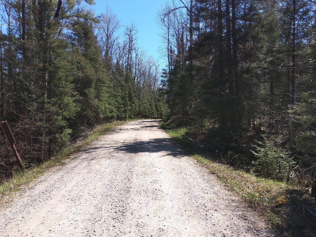
Road Approach - Right
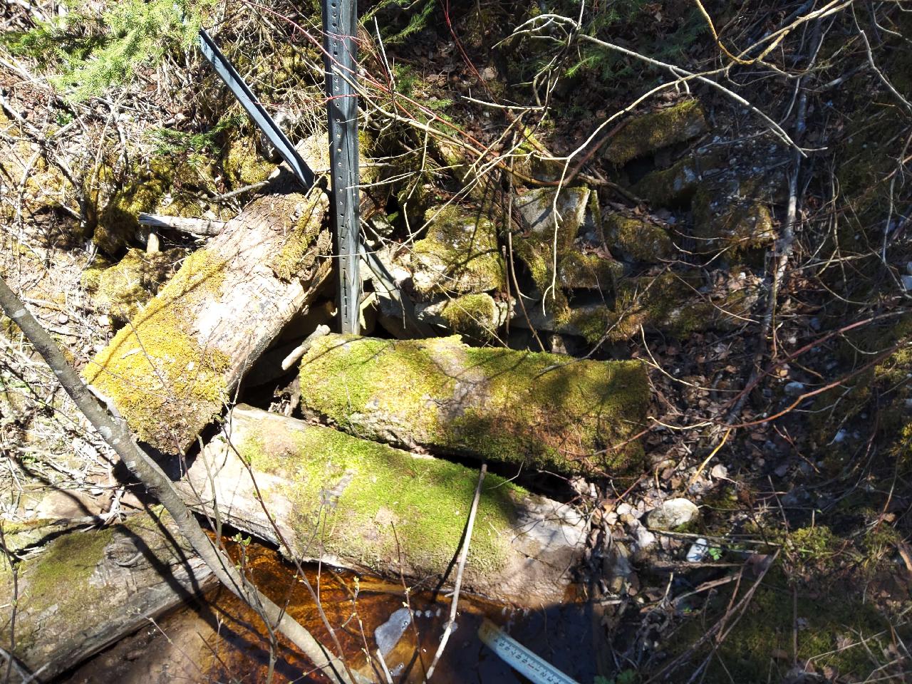
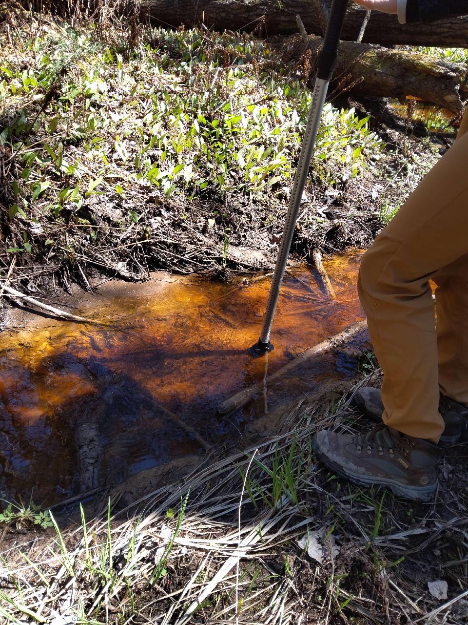
Inlet
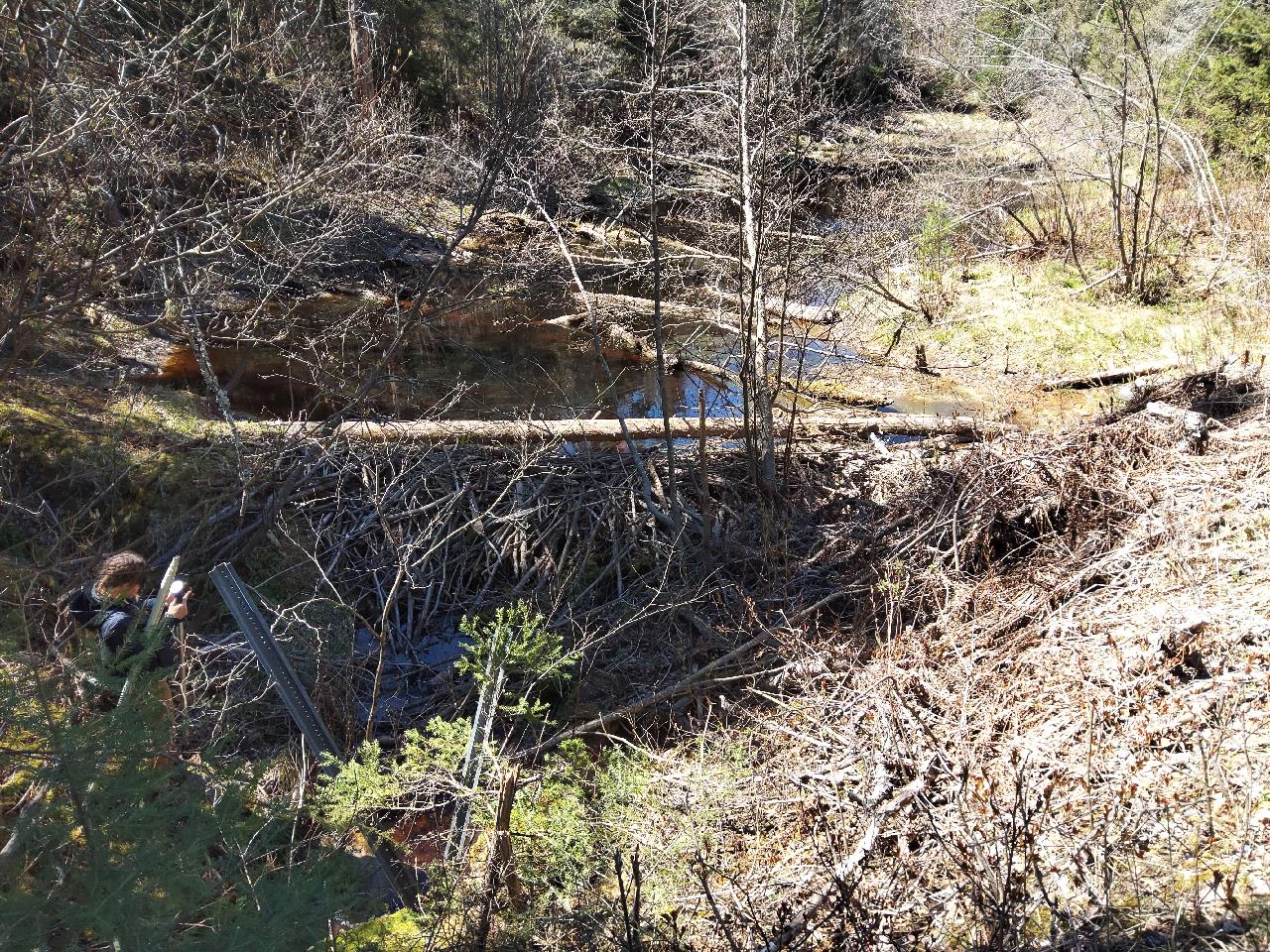
Upstream Conditions
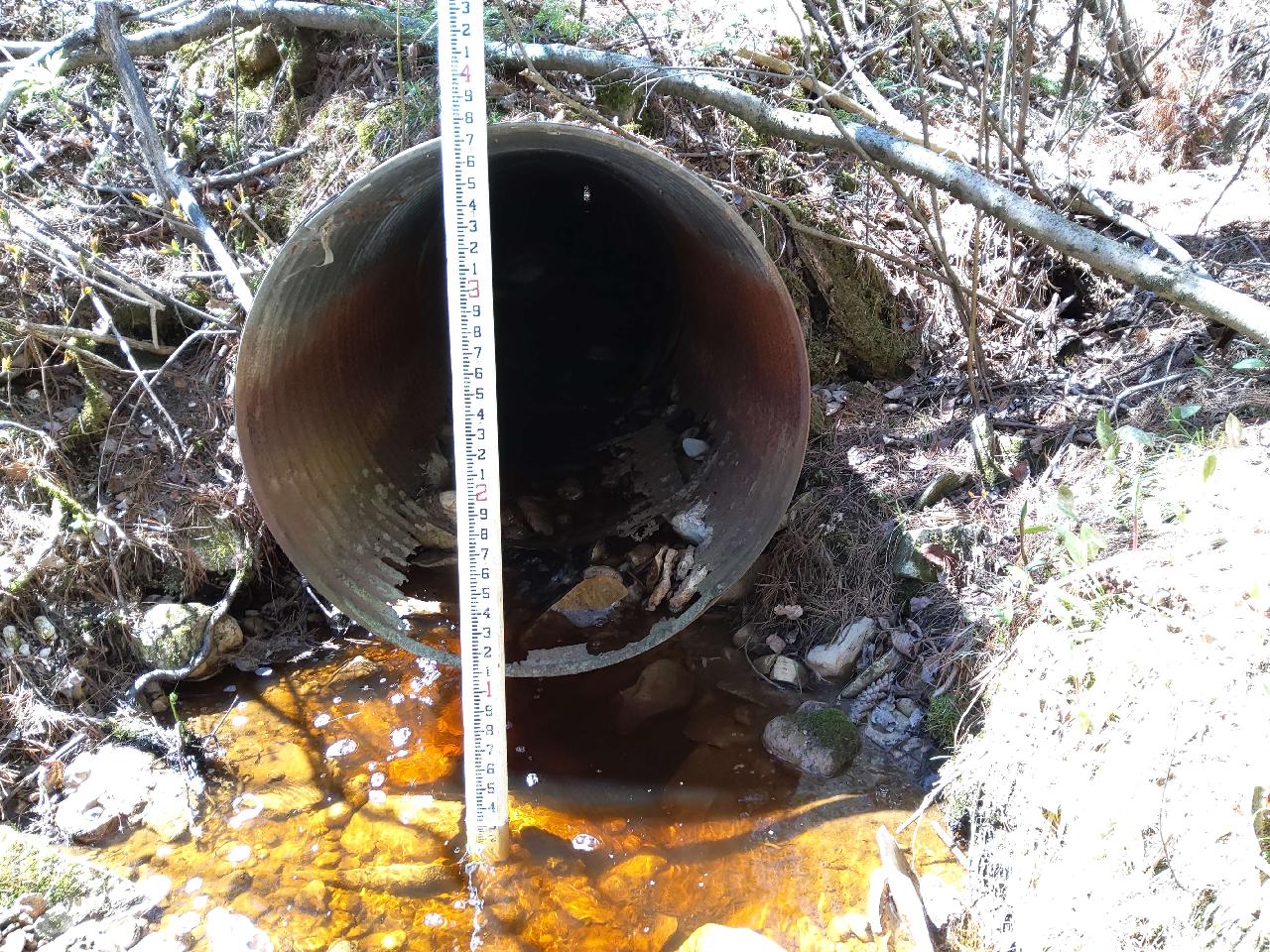
Outlet
Representative Reach
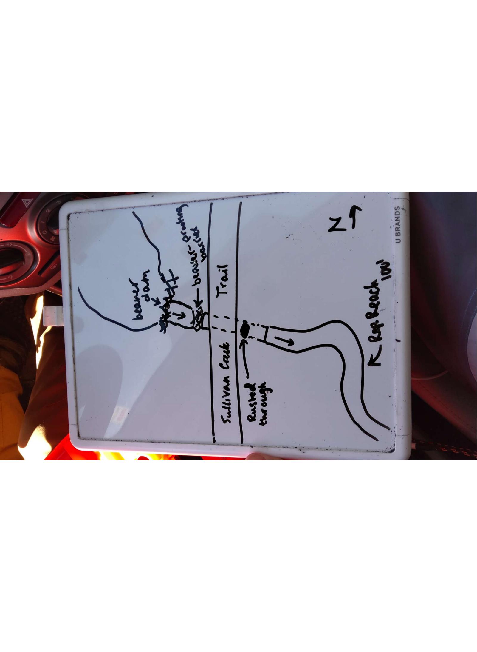
Site Sketch
Crossing Information*
Type of Crossing: Culvert(s)
Number of Structures: 1
Inlet Type: Other
Outlet Type: Freefall into Pool
Structure Material: Metal
Structure Substrate: Mixture
General Conditions: Severe deterioration from corrosion or abrasion (more than 50% of the structure is rusted through) or cracking or spalling or chipping (more than 50% of the structure is compromised). Or Major shape changes (described above) reducing the capacity of the structure by greater than 50%. OR Segment disconnect causing major subsurface erosion/piping and/or partial fill failure and/or sink holes in the fill.
Structure Interior: Corrugated
Is Structure Rusted through? Yes
Dimensions of Structure: Length 42 ft. Width 3 ft. Height 3 ft.
Percentage Plugged: 61% - 80% Inside,Inlet
Percentage Crushed: 21% - 40%
Perch Height: 0.5 ft.
Structure Inlet
Water Depth: 0.3 ft.
Embedded Depth of Structure: 0 ft.
Water Velocity*: 0.7 ft./sec.
Structure Outlet
Water Depth: 0.1 ft.
Embedded Depth of Structure: 0 ft.
Water Velocity*: 1.2 ft./sec.
*Water Velocities were measured 0.1 ft. below the surface (via Flow Meter).
Stream Information
Stream Flow: < 1/2 Bankfull � The stream channel is less than half filled with water.
Stream Flow Type: Perennial (if flowing during the time of assessment.)
Is Scour Pool Present? No
Is Upstream Ponding Present? Yes
Pond: Length 200 ft., Width 50 ft.
Riffle Information
Water Depth: 0.3 ft.
Bankfull Width: 6.5 ft.
Wetted Width: 3 ft.
Water Velocity: 0.5 ft./sec. (measured via Flow Meter)
Dominant Substrate: Clay � very fine particles that stick together
Road Information
Road Surface: Gravel
Owner: Federal
Road Condition: Old Pavement or Rutted, Minor cracking or rutting/ponding at crossing all or part of crossing length.
Road Core Integrity: Fair (some of the symptoms may be present, but not to an extent posing high risk to the crossing)
Road Width at Culvert: 14 ft.
Location of Low Point: At Stream
Runoff Path: Ditch
Embankments
Upstream
Fill Depth: 6.2 ft.
Slope: Moderate, 2:1, 22.5�, or 41%
Downstream
Fill Depth: 6.8 ft.
Slope: Moderate, 2:1, 22.5�, or 41%
Approaches
Left Approach
Length: 475 ft.
Slope: < 1%
Vegetation: Heavy, Ditch is fully vegetated or rip-rapped with no signs of erosion.
Erosion Estimate: 0.09 tons/year
Right Approach
Length: 170 ft.
Slope: < 1%
Vegetation: Heavy, Ditch is fully vegetated or rip-rapped with no signs of erosion.
Erosion Estimate: 0.27 tons/year
Erosion Information
Estimate of Total Erosion at Crossing: 0.43 tons/year
Location of Erosion | Erosion Dimensions | Eroded Material | Material Eroded | Extent of Erosion | Estimated Erosion | ||
facing downstream | Length | Width | Depth | Reaching Stream? | (tons/year) | ||
Right Downstream Embankment1 | 3 ft. | 3 ft. | 4 ft. | Yes | Gravelly Loam | Severe (corrective actions recommended) | 0.07 |
1Culvert rusted through
Summary Information
Fish Passability: Barrier
Is a future visit to this site recommended? Yes, Beaver dam greatly impacting culvert.
Were any non-native species observerd at this site? No
Site Comments: Beaver dam
*These data are maintained in the Michigan DNR Road Stream Crossing Inventory.
�