Road Stream Crossing Site EUP_PWR37
Pine River Watershed
H40, Trout Lake Rd
Chippewa County
Information collected by:
Site Location
GPS Coordinates: 46.1867195,-84.7450876
T 044N R 004 Sec 24
Fish Passability: Barrier at Most Flows
Structure is NOT Perched
Total Erosion: 0.06 tons/year
Overall Score: 21
Severity: Moderate
Date Inventoried: 5/28/2021
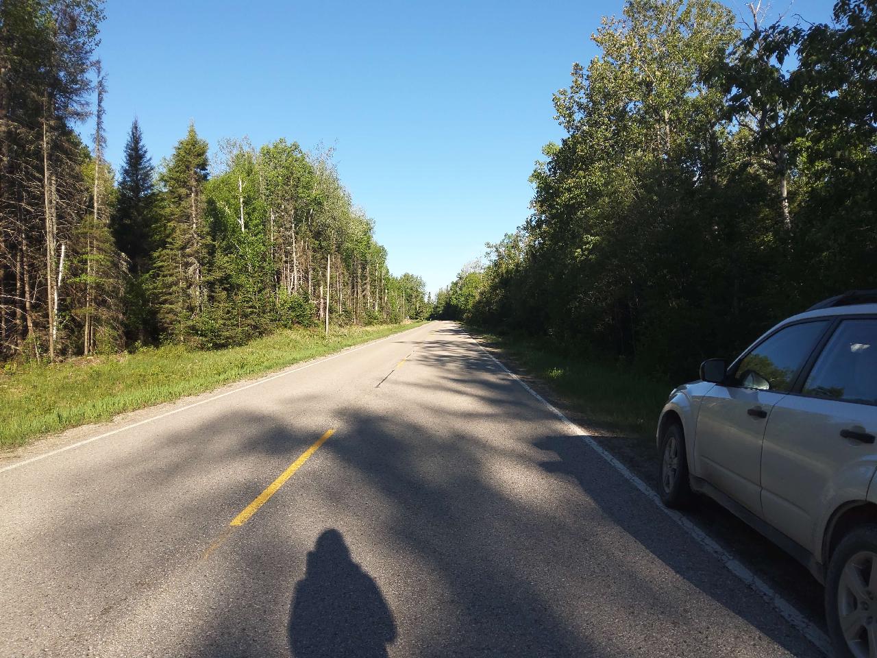
Road Approach - Left
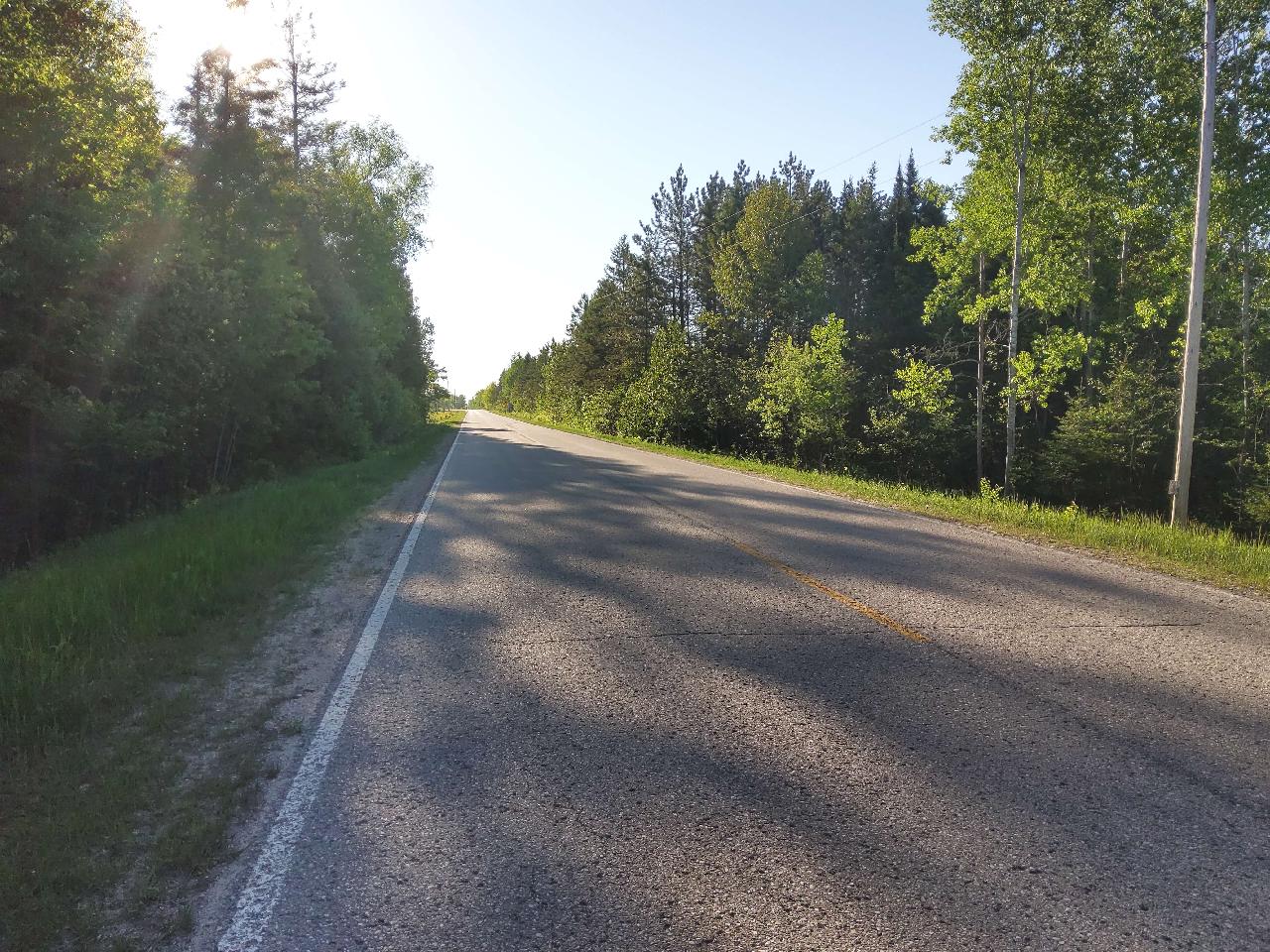
Road Approach - Right
Inlet
Upstream Conditions
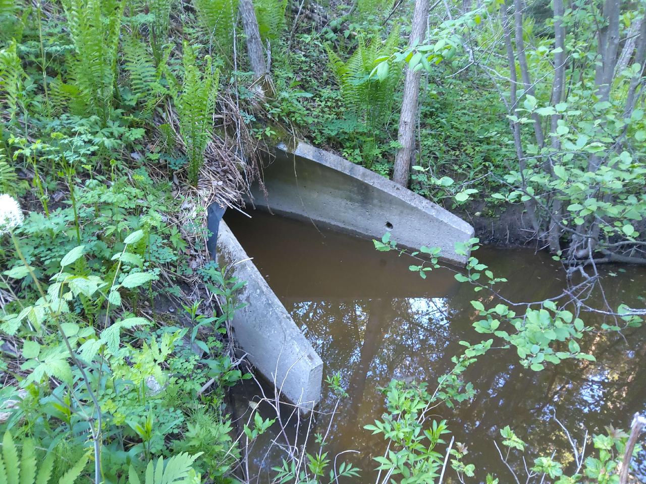
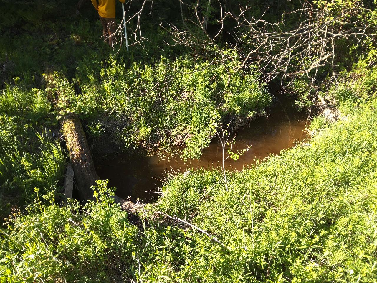
Outlet
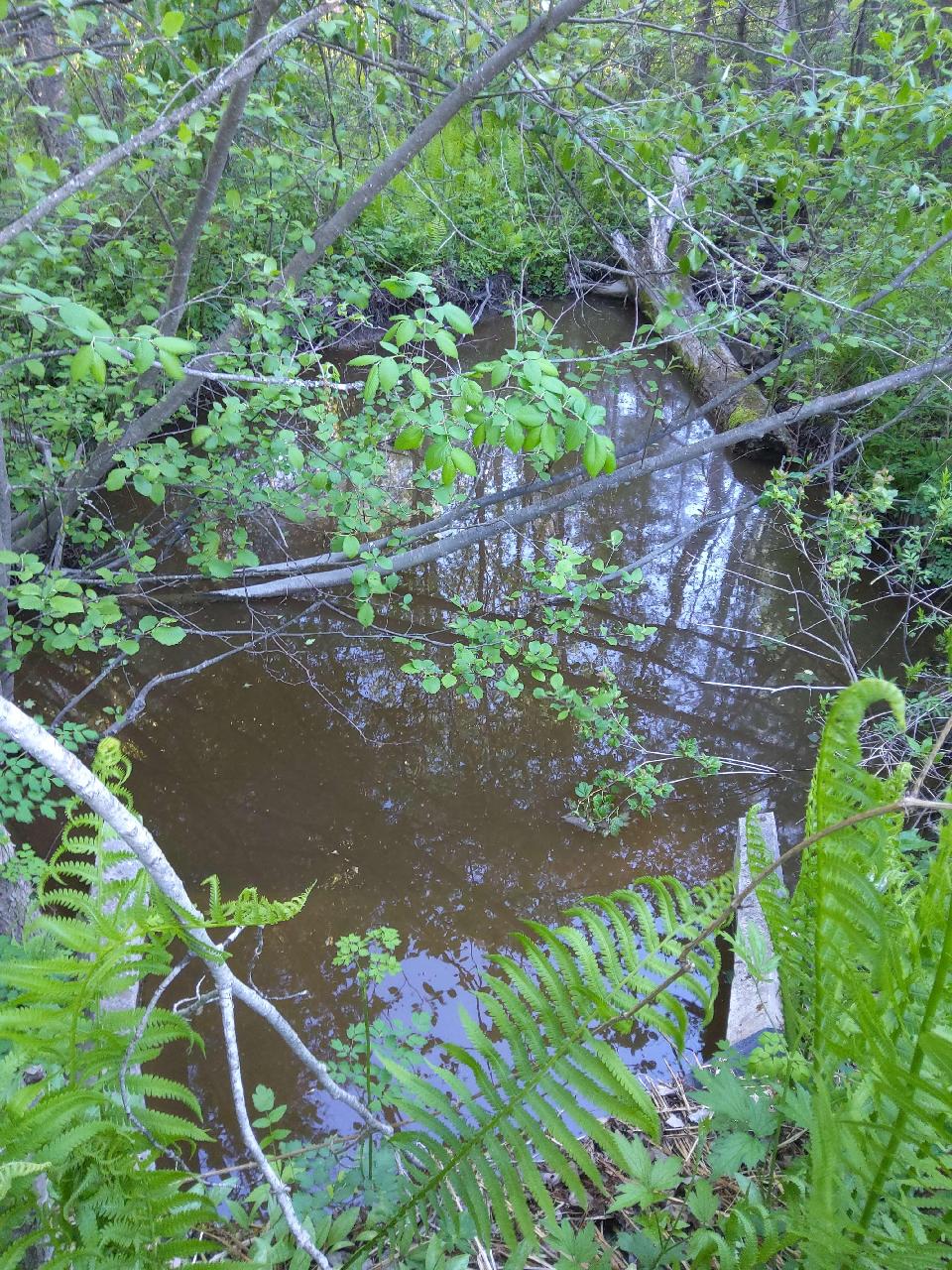
Downstream Conditions

Representative Reach
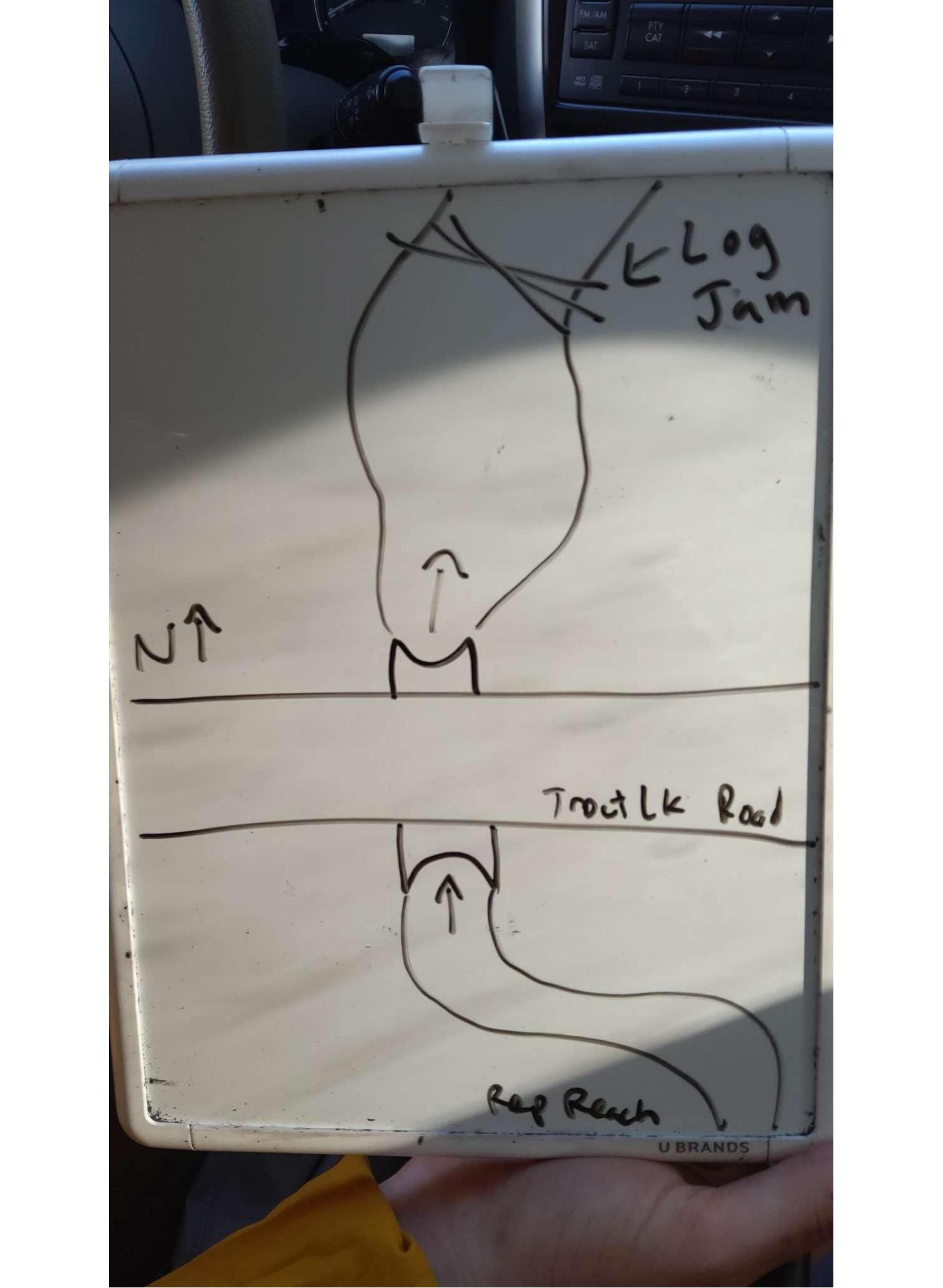
Site Sketch
Crossing Information*
Type of Crossing: Culvert(s)
Number of Structures: 1
Structure Shape: Round
Inlet Type: Apron
Outlet Type: At Stream Grade
Structure Material: Concrete
Structure Substrate: None
General Conditions: Light superficial corrosion or abrasion or chipping or spalling or cracking. No shape changes (described above).
Structure Interior: Smooth
Is Structure Rusted through? No
Dimensions of Structure: Length 80 ft. Width 3.5 ft. Height 3.5 ft.
Percentage Plugged: 1% - 20% Inlet
Percentage Crushed: None or 0%
Structure is NOT Perched
Structure Inlet
Water Depth: 1 ft.
Embedded Depth of Structure: 0 ft.
Water Velocity*: 0.1 ft./sec.
Structure Outlet
Water Depth: 0.5 ft.
Embedded Depth of Structure: 0 ft.
Water Velocity*: 0.1 ft./sec.
*Water Velocities were measured 2 ft. below the surface (via Flow Meter).
Stream Information
Stream Flow: < Bankfull � The stream channel is more than half filled with water, but is not full.
Stream Flow Type: Perennial (if flowing during the time of assessment.)
Is Scour Pool Present? No
Is Upstream Ponding Present? No
Riffle Information
Water Depth: 0.6 ft.
Bankfull Width: 5.7 ft.
Wetted Width: 4 ft.
Water Velocity: 0.1 ft./sec. (measured via Flow Meter)
Dominant Substrate: Sand � particles are smaller than a pinhead and feel gritty between fingers
Road Information
Road Surface: Paved
Owner: County
Road Condition: Old Pavement or Rutted, Minor cracking or rutting/ponding at crossing all or part of crossing length.
Road Core Integrity: Good (no symptoms of lack of integrity)
Road Width at Culvert: 22 ft.
Location of Low Point: At Stream
Runoff Path: Ditch
Embankments
Upstream
Fill Depth: 7.2 ft.
Slope: Gentle, 3:1, 15�, or 33%
Downstream
Fill Depth: 7.6 ft.
Slope: Gentle, 3:1, 15�, or 33%
Approaches
Left Approach
Length: 800 ft.
Slope: < 1%
Vegetation: Heavy, Ditch is fully vegetated or rip-rapped with no signs of erosion.
Erosion Estimate: 0.03 tons/year
Right Approach
Length: 750 ft.
Slope: < 1%
Vegetation: Heavy, Ditch is fully vegetated or rip-rapped with no signs of erosion.
Erosion Estimate: 0.03 tons/year
Erosion Information
Estimate of Total Erosion at Crossing: 0.06 tons/year
Summary Information
Fish Passability: Barrier at Most Flows
Is a future visit to this site recommended? No
Were any non-native species observerd at this site? No
Site Comments: Small natural dam downstream of culvert causing ponding near outlet
*These data are maintained in the Michigan DNR Road Stream Crossing Inventory.
�