Road Stream Crossing Site EUP_SI14
Saint Marys River Watershed, Unnamed
E North Shore Drive
Chippewa County
Information collected by:
Site Location
GPS Coordinates: 46.5243695,-84.1597098
T 048N R 002 Sec 27
Fish Passability: Not Assessed
Perch Height: 2 ft.
Total Erosion: 4.14 tons/year
Overall Score: 42
Severity: Severe
Date Inventoried: 7/1/2021

Road Approach - Left

Road Approach - Right
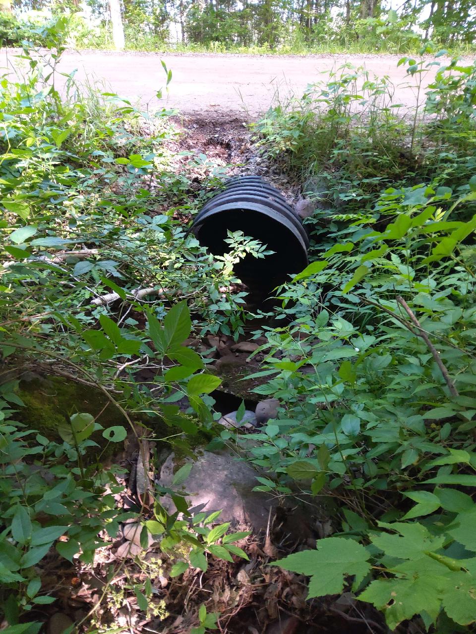
Inlet

Upstream Conditions
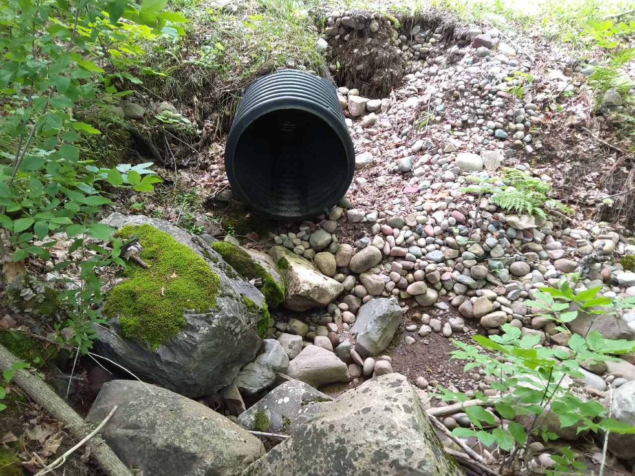
Outlet
Downstream Conditions

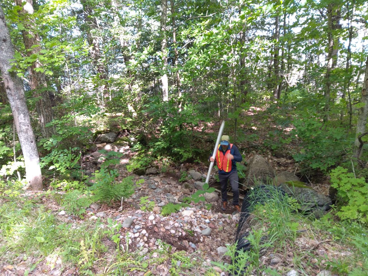
Representative Reach
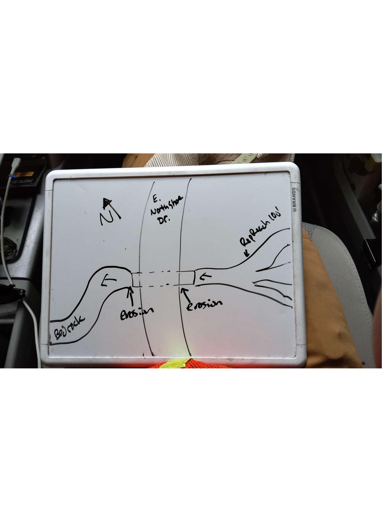
Site Sketch
Crossing Information*
Type of Crossing: Culvert(s)
Number of Structures: 1
Structure Shape: Round
Inlet Type: Projecting
Outlet Type: At Stream Grade
Structure Material: Plastic
Structure Substrate: None
General Conditions: No deficiencies. New structure or nearly new condition.
Structure Interior: Smooth
Is Structure Rusted through? No
Dimensions of Structure: Length 40 ft. Width 3 ft. Height 3 ft.
Percentage Plugged: None or 0%
Percentage Crushed: None or 0%
Perch Height: 2 ft.
Structure Inlet
Water Depth: 0 ft.
Embedded Depth of Structure: 0 ft.
Water Velocity*: 0 ft./sec.
Structure Outlet
Water Depth: 0 ft.
Embedded Depth of Structure: 0 ft.
Water Velocity*: 0 ft./sec.
*Water Velocities were measured at the surface (via Float Test).
Stream Information
Stream Flow: None � The streambed is dry and there is no water flow.
Stream Flow Type: Ephemeral (if channel is dry and appears to flow only after heavy rains, may be covered in organic debris indicating it has not flowed recently).
Is Scour Pool Present? No
Is Upstream Ponding Present? No
Riffle Information
Water Depth: 0 ft.
Bankfull Width: 4 ft.
Wetted Width: 0 ft.
Water Velocity: 0 ft./sec. (measured via Float Test)
Dominant Substrate: Cobble � baseball-sized or larger rocks (10in)
Road Information
Road Surface: Gravel
Owner: County
Road Condition: New Pavement or Well Graded, Same condition as initial placement.
Road Core Integrity: Fair (some of the symptoms may be present, but not to an extent posing high risk to the crossing)
Road Width at Culvert: 17 ft.
Location of Low Point: At Stream
Runoff Path: Ditch
Embankments
Upstream
Fill Depth: 0.8 ft.
Slope: Gentle, 3:1, 15�, or 33%
Downstream
Fill Depth: 1 ft.
Slope: Gentle, 3:1, 15�, or 33%
Approaches
Left Approach
Length: 350 ft.
Slope: 6-10%
Vegetation: Heavy, Ditch is fully vegetated or rip-rapped with no signs of erosion.
Erosion Estimate: 2.4 tons/year
Right Approach
Length: 300 ft.
Slope: 6-10%
Vegetation: Heavy, Ditch is fully vegetated or rip-rapped with no signs of erosion.
Erosion Estimate: 0.65 tons/year
Erosion Information
Estimate of Total Erosion at Crossing: 4.14 tons/year
Location of Erosion | Erosion Dimensions | Eroded Material | Material Eroded | Extent of Erosion | Estimated Erosion | ||
facing downstream | Length | Width | Depth | Reaching Stream? | (tons/year) | ||
Left Downstream Embankment | 8 ft. | 5 ft. | 4 ft. | Yes | Gravel | Severe (corrective actions recommended) | 1.07 |
Right Upstream Embankment | 2.5 ft. | 2 ft. | 1 ft. | No | Gravel | Moderate (corrective actions recommended) | 0.02 |
Summary Information
Fish Passability: Not Assessed
Is a future visit to this site recommended? Yes, A larger culvert is needed.
Were any non-native species observerd at this site? No
Site Comments: Very flashy river. Landowner approached us and told us this culvert has been washed out many times.
*These data are maintained in the Michigan DNR Road Stream Crossing Inventory.
�