Road Stream Crossing Site EUP_SI16
Saint Marys River Watershed, Wilmar Creek
E 1 1/2 Mile Road
Chippewa County
Information collected by:
Site Location
GPS Coordinates: 46.4848119,-84.1913687
T 047N R 002 Sec 09
Fish Passability: Barrier at High Flows
Structure is NOT Perched
Total Erosion: 0.47 tons/year
Overall Score: 15
Severity: Moderate
Date Inventoried: 7/1/2021
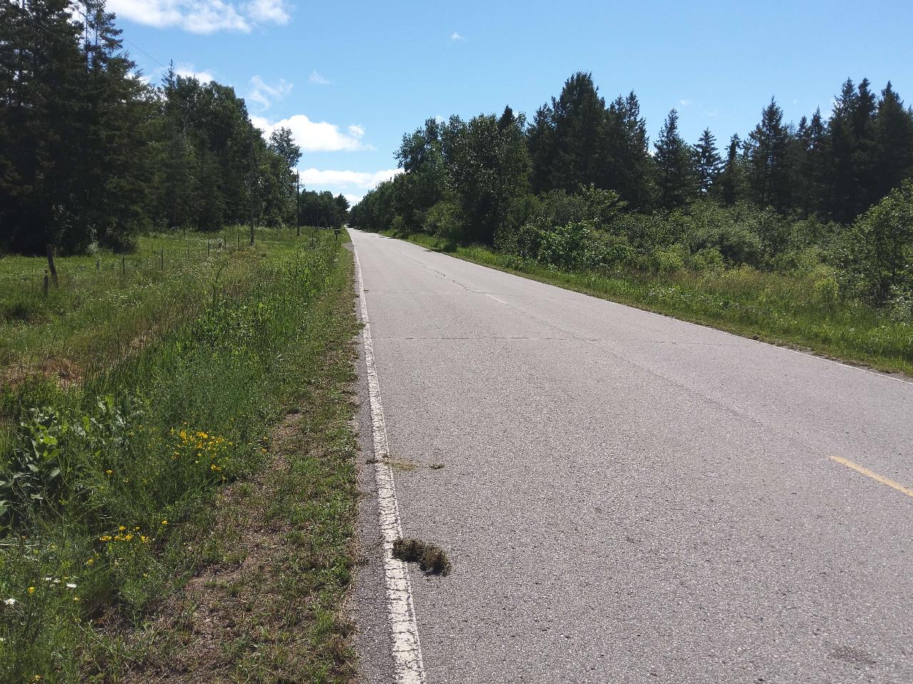
Road Approach - Left

Road Approach - Right
Inlet

Upstream Conditions
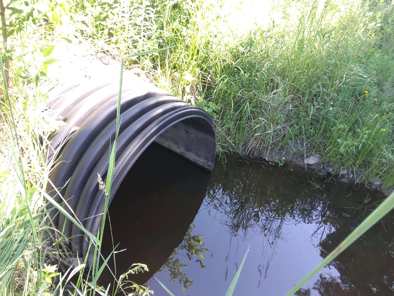
Outlet
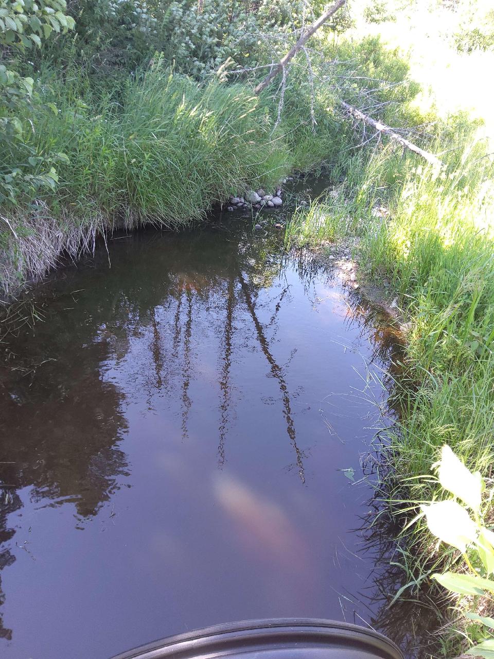
Downstream Conditions
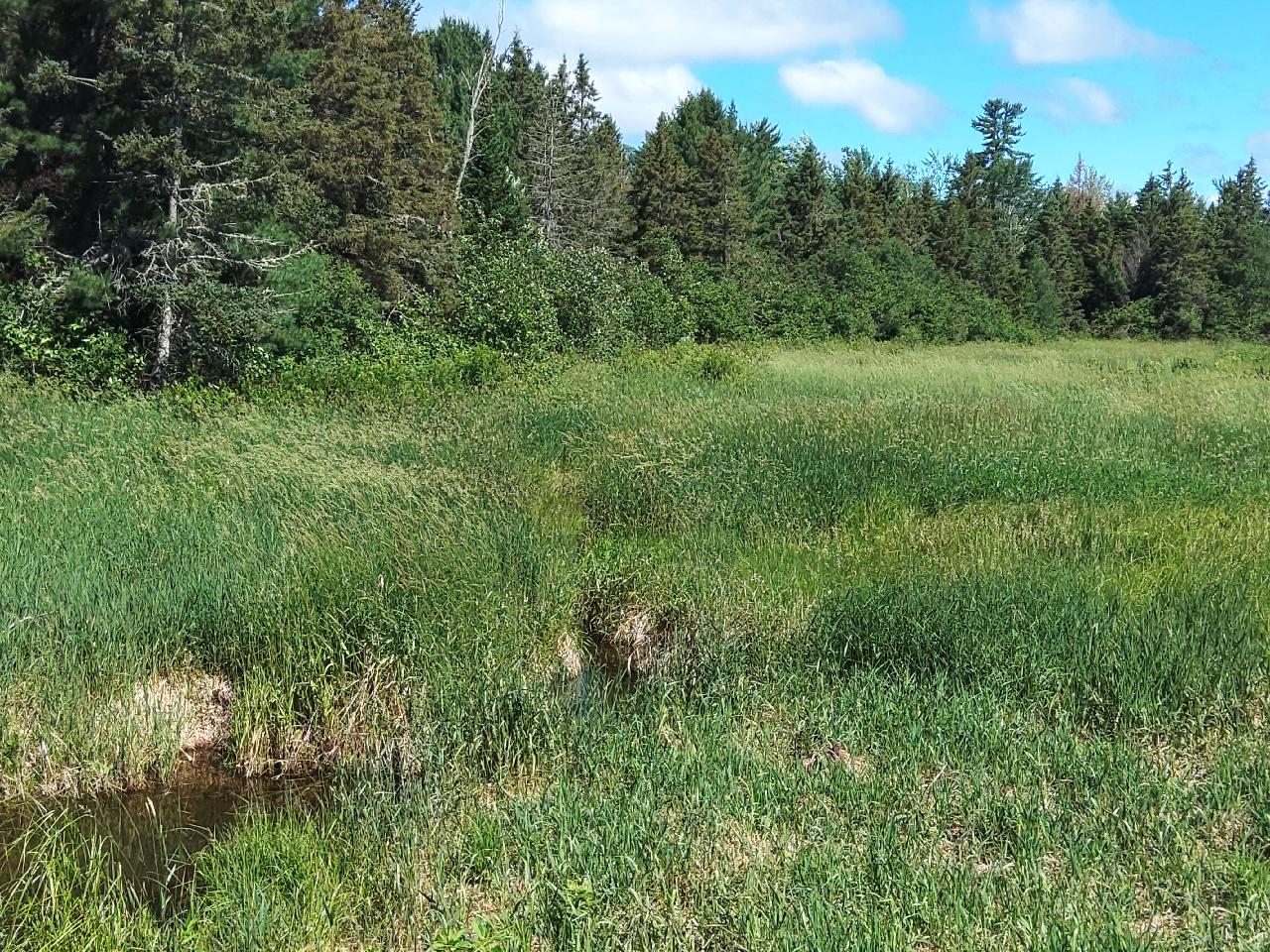
Representative Reach
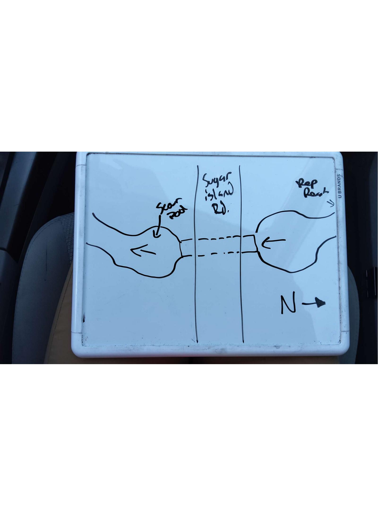
Site Sketch
Crossing Information*
Type of Crossing: Culvert(s)
Number of Structures: 1
Structure Shape: Round
Inlet Type: Projecting
Outlet Type: At Stream Grade
Structure Material: Plastic
Structure Substrate: None
General Conditions: No deficiencies. New structure or nearly new condition.
Structure Interior: Corrugated
Is Structure Rusted through? No
Dimensions of Structure: Length 64 ft. Width 4 ft. Height 4 ft.
Percentage Plugged: None or 0%
Percentage Crushed: None or 0%
Structure is NOT Perched
Structure Inlet
Water Depth: 2.1 ft.
Embedded Depth of Structure: 0 ft.
Water Velocity*: 0 ft./sec.
Structure Outlet
Water Depth: 2 ft.
Embedded Depth of Structure: 0 ft.
Water Velocity*: 0 ft./sec.
*Water Velocities were measured at the surface (via Float Test).
Stream Information
Stream Flow: < 1/2 Bankfull � The stream channel is less than half filled with water.
Stream Flow Type: Perennial (if flowing during the time of assessment.)
Is Scour Pool Present? Yes
Scour Pool: Length 12 ft., Width 7 ft., Depth 3 ft.
Is Upstream Ponding Present? Yes
Pond: Length 15 ft., Width 10 ft.
Riffle Information
Water Depth: 1.5 ft.
Bankfull Width: 4 ft.
Wetted Width: 3 ft.
Water Velocity: 0 ft./sec. (measured via Float Test)
Dominant Substrate: Silt � very fine particles that don't stick together
Road Information
Road Surface: Paved
Owner: County
Road Condition: New Pavement or Well Graded, Same condition as initial placement.
Road Core Integrity: Good (no symptoms of lack of integrity)
Road Width at Culvert: 22 ft.
Location of Low Point: At Stream
Runoff Path: Ditch
Embankments
Upstream
Fill Depth: 3.5 ft.
Slope: Gentle, 3:1, 15�, or 33%
Downstream
Fill Depth: 3 ft.
Slope: Gentle, 3:1, 15�, or 33%
Approaches
Left Approach
Length: 1000 ft.
Slope: 1-5%
Vegetation: Heavy, Ditch is fully vegetated or rip-rapped with no signs of erosion.
Erosion Estimate: 0.41 tons/year
Right Approach
Length: 200 ft.
Slope: 1-5%
Vegetation: Heavy, Ditch is fully vegetated or rip-rapped with no signs of erosion.
Erosion Estimate: 0.06 tons/year
Erosion Information
Estimate of Total Erosion at Crossing: 0.47 tons/year
Summary Information
Fish Passability: Barrier at High Flows
Is a future visit to this site recommended? No
Were any non-native species observerd at this site? Yes, Leafy spurge, wild parsnip, birds -foot trefoil, spotted knapweed.
Site Comments: Undersized culvert
*These data are maintained in the Michigan DNR Road Stream Crossing Inventory.
�