Road Stream Crossing Site Mu-Albermarle
Muskegon River Watershed, Unnamed
Albermarle Rd
Roscommon County
Information collected by:
Site Location
GPS Coordinates: 44.5019797,-84.7736983
T 024N R 004 Sec 03
Fish Passability: Barrier at High Flows
Structure is NOT Perched
Total Erosion: 2.96 tons/year
Overall Score: 49
Severity: Severe
Date Inventoried: 4/29/2022
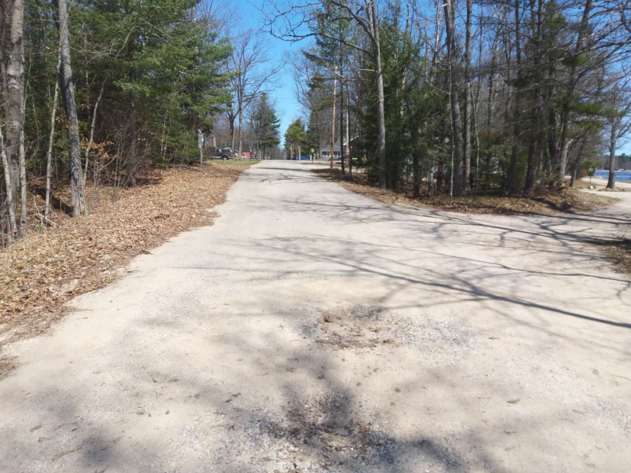
Road Approach - Left

Road Approach - Right
Inlet
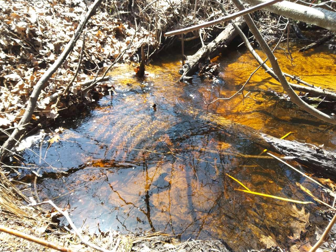
Upstream Conditions
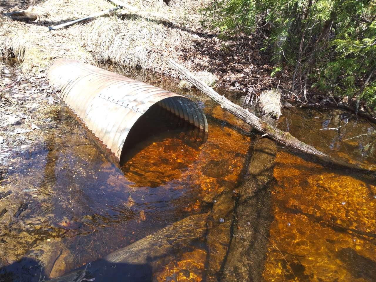
Outlet

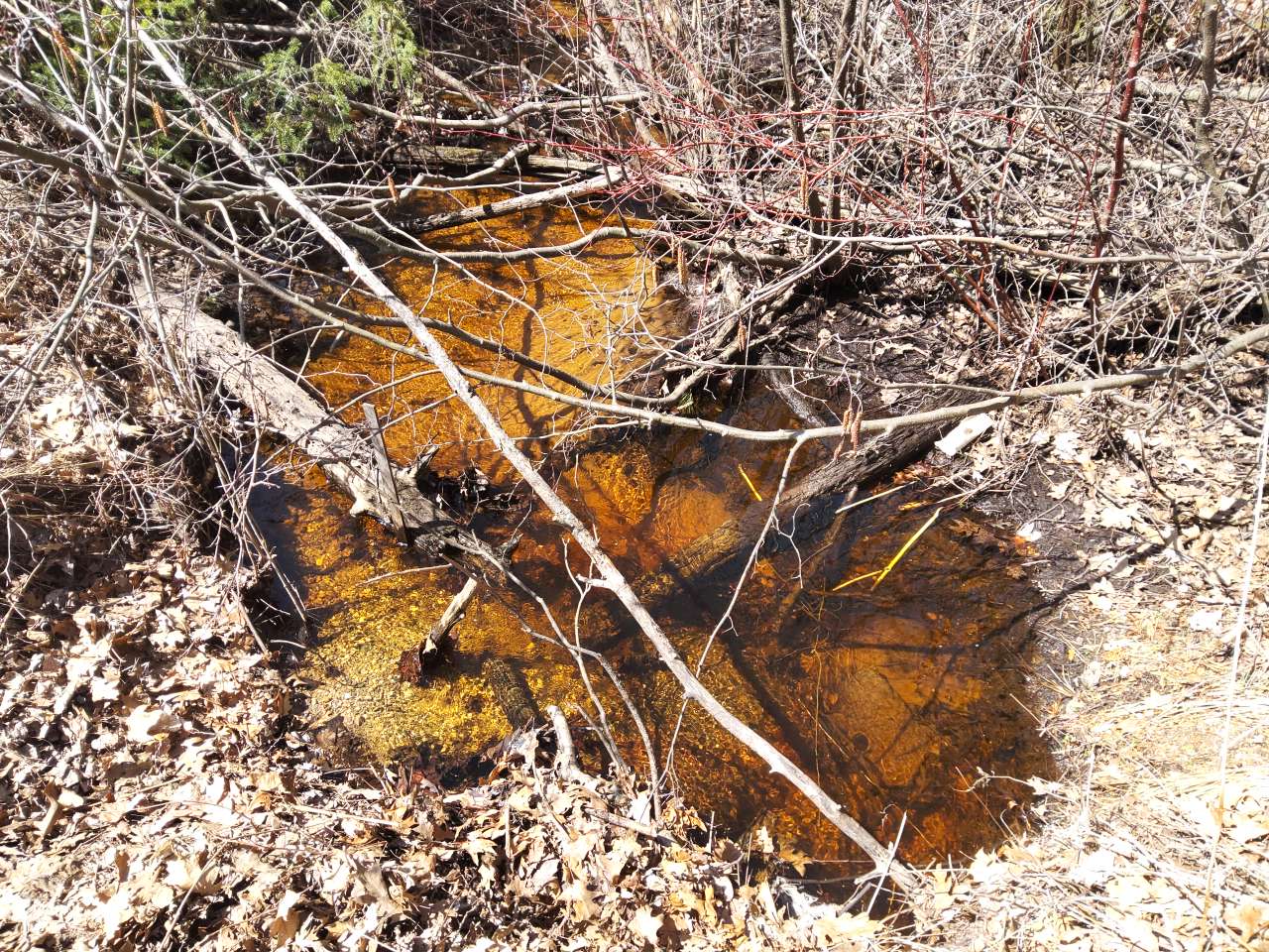
Downstream Conditions

Representative Reach

Site Sketch
Crossing Information*
Type of Crossing: Culvert(s)
Number of Structures: 1
Structure Shape: Round
Inlet Type: Projecting
Outlet Type: At Stream Grade
Structure Material: Metal
Structure Substrate: Mixture
General Conditions: Major deterioration from corrosion or abrasion (10-50% of the length of structure is rusted through) or cracking or spalling or chipping (large chunks sloughing off, large cracks, exposed metal reinforcement). OR Major shape changes (described above) reducing the capacity of the structure by up to 50%. OR segment disconnection with evidence of water piping under or around the culvert.
Structure Interior: Corrugated
Is Structure Rusted through? No
Dimensions of Structure: Length 60 ft. Width 2.5 ft. Height 2.5 ft.
Percentage Plugged: 41% - 60% Inlet
Percentage Crushed: 61% - 80%
Structure is NOT Perched
Structure Inlet
Water Depth: 0.8 ft.
Embedded Depth of Structure: 1.7 ft.
Water Velocity*: 1.1 ft./sec.
Structure Outlet
Water Depth: 1.2 ft.
Embedded Depth of Structure: 0.2 ft.
Water Velocity*: 0.6 ft./sec.
*Water Velocities were measured 0.6 ft. below the surface (via Flow Meter).
Stream Information
Stream Flow: < Bankfull � The stream channel is more than half filled with water, but is not full.
Stream Flow Type: Perennial (if flowing during the time of assessment.)
Is Scour Pool Present? No
Is Upstream Ponding Present? Yes
Pond: Length 6 ft., Width 6 ft.
Riffle Information
Water Depth: 0.8 ft.
Bankfull Width: 9.2 ft.
Wetted Width: 7 ft.
Water Velocity: 0.8 ft./sec. (measured via Flow Meter)
Dominant Substrate: Sand � particles are smaller than a pinhead and feel gritty between fingers
Road Information
Road Surface: Gravel
Owner: County
Road Condition: Broken Pavement or Rilled/Gullied, Multiple patches, cracks, rilling, or gullies at crossing.
Road Core Integrity: Poor (one or more symptoms are present and are compromising the integrity of the crossing)
Road Width at Culvert: 22 ft.
Location of Low Point: At Stream
Runoff Path: Roadway
Embankments
Upstream
Fill Depth: 4.5 ft.
Slope: Steep, 1:1, 45�, or 100%
Downstream
Fill Depth: 4 ft.
Slope: Moderate, 2:1, 22.5�, or 41%
Approaches
Left Approach
Length: 375 ft.
Slope: 1-5%
Vegetation: Partial, Ditch has some vegetation and some bare, eroding places.
Erosion Estimate: 1.34 tons/year
Right Approach
Length: 50 ft.
Slope: 1-5%
Vegetation: Partial, Ditch has some vegetation and some bare, eroding places.
Erosion Estimate: 0.02 tons/year
Erosion Information
Estimate of Total Erosion at Crossing: 2.96 tons/year
Location of Erosion | Erosion Dimensions | Eroded Material | Material Eroded | Extent of Erosion | Estimated Erosion | ||
facing downstream | Length | Width | Depth | Reaching Stream? | (tons/year) | ||
Right Upstream Streambank | 5 ft. | 8 ft. | 4 ft. | Yes | Gravel | Severe (corrective actions recommended) | 1.6 |
Summary Information
Fish Passability: Barrier at High Flows
Is a future visit to this site recommended? Yes, Culvert is set to be replaced in July 22.
Were any non-native species observerd at this site? No
Site Comments: Crushed culvert Road
*These data are maintained in the Michigan DNR Road Stream Crossing Inventory.
�