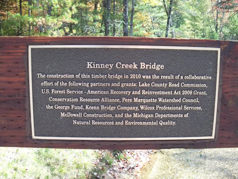
Road Stream Crossing Site PM_L015
Pere Marquette River Watershed, Kinney Creek
Wingleton Rd
Sweetwater Twp,
Lake County
Information collected by:
Site Location
GPS Coordinates: 43.906225
, -85.927228
T18N
R14W
Sec 36
Owned by Private
Site ID
Inlet
Outlet
Upstream Conditions
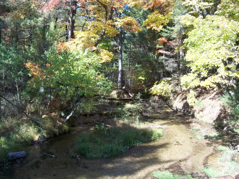
Downstream Conditions
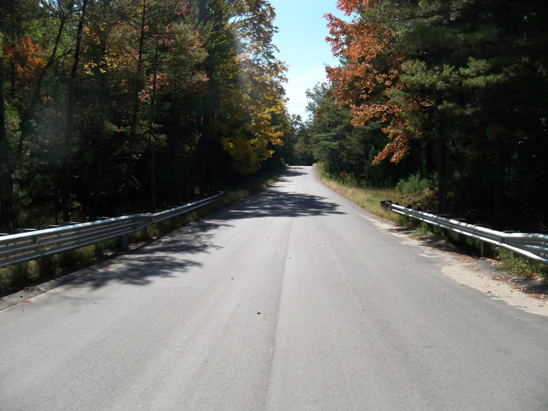
Road Approach - Left
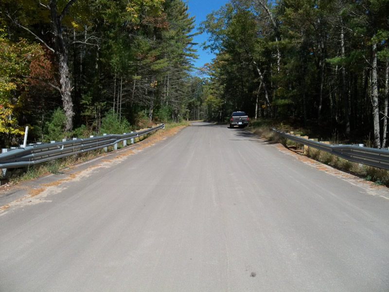
Road Approach - Right
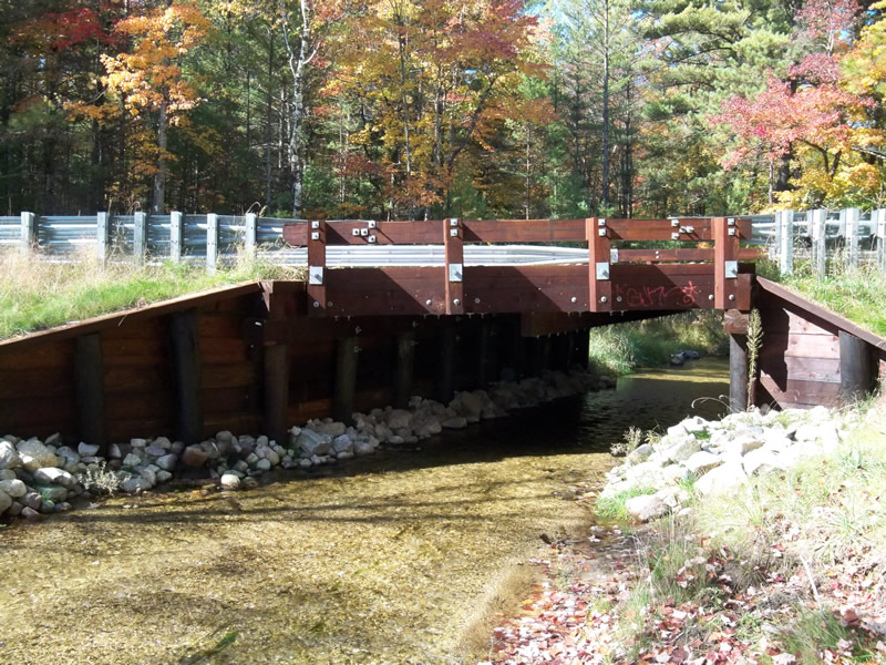
Crossing Information
Type of Crossing: Bridge
Structure Shape: Open Bottom Square/Rectangle
Inlet Type: Wingwall 30-70 Degree
Outlet Type: Cascade over Riprap
Structure Material: Wood
Structure Substrate: Gravel
General Conditions: New
Structure Interior: smooth
Dimensions of Structure: Length 20 ft.
, Width 16 ft.
, Height 8 ft.
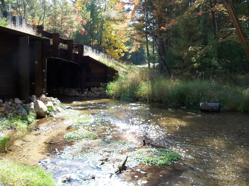
Structure Inlet
Water Depth: 0.5 ft.
Water Velocity*: 1.5 ft./sec.
Structure Outlet
Water Depth: 0.5 ft.
Water Velocity*: 1.7 ft./sec.
*Water Velocities were measured 0.5 ft. below Surface
(with Meter)
Additional Comments
Crossing replaced in 2010.
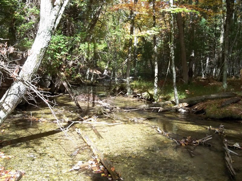
Stream Information
Stream Flow: Less than Bankfull
Riffle Information
Water Depth: 0.7 ft.
Bankfull Width: 20 ft.
Wetted Width: 18 ft.
Water Velocity: 1.2 ft./sec.
(Measured with Meter)
Dominant Substrate: Gravel
Road Information
Paved
County Road
Road Condition: Good
Road Width at Culvert: 28 ft.
Location of Low Point: Other
Runoff Path: Roadway
Fill Depth: 0 ft.
Slope: 1:1.5
Fill Depth: 0 ft.
Slope: 1:1.5
Approaches
Left Approach
Length: 600 ft.
Slope: 1% to 5%
Vegetation: Heavy
LS Factor: 0.52
Erosion: 0.2888 tons/year
Right Approach
Length: 680 ft.
Slope: 1% to 5%
Vegetation: Heavy
LS Factor: 0.532
Erosion: 0.3349 tons/year
Erosion Information
Total Erosion at Crossing: 0.6236 tons/year
Extent of Erosion: Stabilized
Notes:
Diversion outlets functioning.
Summary Information
Erosion is an area of concern for this site.
�